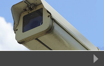
One of the many minor road offences that annoy drivers around the UK is unauthorised vehicles that use bus lanes to avoid queues at traffic lights or roundabouts. Hull Council has recently used Automatic Number Plate Recognition (ANPR) to catch over 10,000 motorists using two of the city’s bus lanes illegally over a two week period.
Global automatic number plate recognition comes to Hull
Although ANPR systems are mainly used by police forces to identify those who are driving without insurance or road tax, or are driving a suspect vehicle, it has many other potential uses, including traffic analysis. The results of Hull’s bus lane trial may result in a permanent fixture of cameras, focused on areas where breach of rules like bus lane usage is high. The Council said that drivers were less likely to abuse bus lane privileges if they knew they were likely to be caught on camera and fined, and that this would increase the efficiency of public transport.
Such use of these cameras to police offences works if they are well planned and well-advertised, and if the fines are kept within acceptable limits. This may help the driving public to see them as a viable deterrent rather than a cash-generating project for the councils that implement them.
The cost – automatic number plate recognition systems
Just like speed cameras, drivers need clear warnings that such filming is taking place, and in most cases the warning alone is enough to dissuade drivers from creeping into the bus lane in order to gain an advantage over waiting traffic. Reports suggest that those penalised for traffic offences are more likely to pay their fine if they are directed to photo or video proof, and ANPR systems would be extremely useful in this regard. Whilst they may be costly to buy and install, the long term benefits to traffic movement and driver safety is likely to be worth the investment.
Automatic number plate recognition products from RDS
At Road Data Services, we offer specialist automatic number plate recognition software and equipment for traffic survey use. We build these cameras in-house, producing units that are more accurate and reliable than many on the market, and which include infra-red sensors so that they can work just as well in the dark.
Extremely useful for monitoring anything from journey times to car park usage, these ANPR systems offer an outstanding technological solution for a wide range of end users. To find out more about our range of cameras and to talk about your next ANPR or traffic survey project, just contact us today.
When councils are considering significant road improvements or developments, they need to bear a number of considerations in mind. Naturally, smooth traffic flow and access to commercial and retail developments is important, but pedestrian and cycle safety is playing an increasingly important role in decision-making.
Accurate pedestrian surveys
Encouraging sustainable travel is important to councils all across the UK. Schemes to entice people to walk or cycle instead of drive are becoming more common, and if councils want these schemes to succeed, they need to ensure that they provide safe routes, appropriate crossings and designated areas so that these more vulnerable road users are safe.
One of the best ways to assess current usage is to conduct a pedestrian survey. This puts experienced people on the ground in the affected area, talking to pedestrians about how, why and when they use the current routes available and what their opinions are about potential new routes or additional safety measures.
Pedestrian and cycle safety in Bristol
A scheme to improve safety in Bristol is considering all road users. There are two areas – Junction 1 of the M32 and the A4174 at Hambrook. Two separate crossings will be substantially improved by South Gloucestershire Council, who will be spending £1.3million pounds at Hambrook alone. The work will be carried out on existing crossings with the aim of making crossing busy junctions much safer, thereby encouraging people to walk or cycle instead of drive.
This work is part of an £8m scheme in the area that will see work to improve road surfaces for drivers as well as creating safe walking and cycling routes. Funding for some of the work is coming from the Government’s Cycle Ambition Fund, which supports councils who want to add sustainable transport options in their areas.
Pedestrian surveys from RDS
At Road Data Services we can design, carry out and analyse pedestrian surveys across the UK. Our experience means you can leave us to get on with the job, representing your organisation in a friendly and professional manner and extracting the information you need in the best format for you. Our pedestrian surveys have helped councils, developers and other organisations to make the best choices for safer journeys. Contact us today to find out more.
The Highways Agency has been given 18 months to look at ways of tackling pollution on stretches of the M1 and M3 motorways. The affected areas are 32 miles of road between junctions 28 and 31 of the M1 and just 2.8 miles of the M3 between junctions 2 and 4a.
Speed, surveys say, could contribute to higher pollution levels, and one of the solutions had been to impose a 60mph speed limit on both stretches between 7am and 7pm. However, consultation with motorists and with local businesses resulted in a widespread rejection of the plan, and the Transport Secretary, Patrick McLoughlin, has said that this would not be the right solution.
Alternatives to speed reduction
Although a blanket approach to reducing the speed limit has been ruled out, a variable speed restriction could still be imposed on the routes, cutting speed when air pollution is particularly bad. Other solutions include the use of higher barriers which funnel the fumes away from ground level. Already trialled in Holland, these barriers have been found to reduce air pollution and also noise from the carriageway.
Larger vehicles, such as freight-carrying lorries and trucks are also more likely to cause air pollution and a further solution would be to ban those vehicles from the motorway at peak times. This would certainly be objected to by the Road Haulage Association and haulier companies, who would have to change routes and schedules if travel was restricted.
Speed an issue as capacity increased
The concern about air pollution and its relation to the speed of traffic comes as both motorways undergo carriageway improvements to increase capacity and reduce journey time. This is likely to become an issue in other parts of the UK motorway network as motorists and businesses demand better road systems, and local people become concerned about the effect of such work on the environment around them.
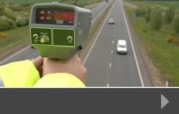
Speed surveys from RDS
We can help to identify areas where speed is an issue – either for road safety or for public health. Use a speed survey in conjunction with a journey time survey or general traffic survey to see where improvements can be made in your area, or how a new development might impact local traffic.
All our traffic surveys are designed to each project and we supply data in the best format for your needs – to find out more, just contact us today.
Councils across the UK are continually looking at sustainable and successful ways to develop land for housing, business and retail. These projects tend to face local opposition for a variety of reasons, one of which is traffic and transport management.
Travellers who are already faced with delays and congestion on their way to work, school or the shops, simply don’t want more traffic on the roads, so it makes sense for developers and planning authorities to pay attention to the impact of development on local traffic routes and suggest new traffic management schemes that might help.
Residents in Northampton conduct own traffic survey
In the Whitehills and Spring Park areas of Northampton, residents are concerned about the traffic implications of a house-building project that has been approved by the local Council. Several hundred homes are due to be built in the future, and residents are worried that the traffic on the A508, already busy at peak times, will be unmanageable once the new site is occupied.
To illustrate their point, a group of residents carried out a traffic survey over a 10-day period. Although not as precise or scientific as a professionally-designed survey would be, the group reported some crucial findings. A roundabout on the route regularly causes traffic queues, and between 7.30am and 8.30am, an average of 871 cars queued to get around the roundabout, travelling at a speed of around 3mph.
Traffic at the heart of development
Few development schemes are traffic-free or create no additional traffic on nearby routes, so making transport planning a key part of the development plan is essential – not just to keep existing residents and road users happy, but to ensure a sustainable travelling future for all local road users. This might include a straightforward traffic survey, but if developments are close to schools or hospitals, planners should also look at pedestrian issues and consider other road users, such as cyclists. Choosing to integrate traffic planning into new developments is essential if we want to keep people moving.
Traffic surveys and more from RDS
For professional advice and experienced traffic survey planning, execution and reporting, talk to Road Data Services. We work with developers, planning committees, local councils and interested parties to collect the data that helps you to make the best decisions for your community or for a wider transport scheme. Just call us today to find out more.
Reports suggest that the government is considering increasing the penalty for speeding fines by up to four times, in a move that it hopes will dissuade drivers from breaking speed limits on motorways and other roads. This is despite claims from road user groups that traffic speed surveys and other research shows that overall speeds have dropped in recent years.
Motorway speed fine up to £10,000
Ministers are suggesting that the highest speeding penalties on a motorway are raised from £2,500 currently to £10,000. They are also recommending that the fines for speeding for dual carriageways and general roads across the UK rise from £1,000 to £4,000. Introducing higher fines for other offences, such as driving whilst using a mobile phone, or driving without insurance are designed to discourage motorists from breaking these laws.
Motorists already slowing down
The speed laws are some of the most-often broken in the UK, and some road safety campaigners are more worried about enforcing the lower speed limits than the upper ones. Travelling at 40mph in a 30mph zone is seen by many as being more dangerous than travelling at 80mph on the motorway instead of 70mph. Groups that represent motorists, however, say that the current fines system seems to have had a positive effect on the speed we drive at, with research showing that we are generally driving more slowly and safer than at previous times.
Just in it for the money?
Of course, higher fines means more money in the government coffers, and many feel that this is a form of stealth tax. It is not known exactly when these changes will come into force, as they still need to be debated and approved by Parliament.
Speed surveys from RDS
If you are concerned about traffic speeds in your area, start by collecting accurate data that shows exactly what’s happening. Our tailored traffic speed surveys give you a clear picture of road use and road speed in a defined area. This helps planners to look at new road layouts, road traffic calming measures, safe pedestrian crossings and other road safety measures that can help to cut speed and keep road users safe.
To find out more about how we can help, either with existing road issues or for new road planning, just contact us today.
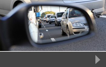
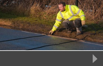

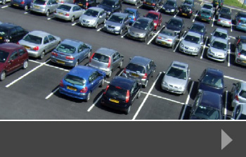
Parking Surveys
ANPR and Bluetooth

Pedestrian Surveys
<a title="Interview Surveys" href="http://www.rdservices prix viagra en pharmacie.co.uk/interview-surveys/”>

Interview Surveys
An AA Populous survey of over 24,000 members found that more than two thirds of respondents want to be consulted before 20mph speed limits are imposed on the streets where they live.
The survey, which focused on the 20mph speed limit, is being increasingly used in streets across the country which could reduce accidents. Key areas where a 20mph limit is introduced include near to schools and hospitals, where vulnerable people are more likely to be using the roads.
The AA also found that those whose regular journeys might be affected by a lower speed limit wanted to be consulted first.
The motoring organisation asked respondents a series of questions about the 20mph limit, and invited them to agree or disagree. Responses were then analysed, with a geographical segmentation added, to see how responses differed across the country.
Speed consultations high on the agenda
Only 32% of respondents agreed with the statement: “20mph speed limits across residential neighbourhoods offer such a great road safety benefit that residents’ views need not be taken into account.” 61% agreed that: “Speed camera enforcement should only be used in 20mph speed limit zones when a specific problem emerges.” And 44% said they would “…support police-approved speed checks carried out by local residents along a 20mph speed limit in my neighbourhood.”
Edmund King, the AA’s president commented: “Neighbourhoods face differing challenges from traffic: some may need to slow down their own residents and reduce the risk of accidents, others have a ‘rat-running’ problem that a 20mph speed limit on its own won’t address. That is one of the reasons why, not only do 69% of AA members want a say on lower speed limits along their own streets, but 55% of them want to give an opinion on local zones restricted to 20mph.”
Why speed surveys can help
You can see if there is a problem on streets in your locality by conducting a simple traffic speed survey. This survey is designed to look at speed on a certain section of road at various times of the day, giving accurate data on speed and road usage, which is invaluable when consulting with residents and making a decision on speed limit enforcement.
At RDS, we design, conduct and report on a range of specialist road surveys, including speed surveys and traffic surveys, giving you the quality data and advice you need to make the best recommendations or decisions.
With towns and cities across the UK competing for businesses to choose them as a location for office or manufacturing space, it’s vital that they look at the key areas of importance to those businesses. For many, it’s the ease of access to business parks or central areas, along with a supply of affordable housing, skilled people and good facilities. Towns and cities that struggle with traffic management could get left behind.
Why commission a traffic survey?
There are many reasons why developers, councillors and planners need to have accurate and up-to-date information on the traffic in their area. Planning a new business park on the outskirts of town may attract business, but councils also need to keep local people and existing businesses happy, so the ease of travel to and from a new development, alongside a clear understanding of parking issues is vital. This is knowledge that should be acquired in the early stages of development, rather than as an afterthought.
Parking is often a problem, both for cities that are attracting large businesses, and towns where parking options are often limited. Many towns address this problem by developing park and ride schemes, which require land at the edge of the business area, but reduce the amount of traffic travelling through the centre of town. A parking survey can help to ascertain the reasons people are parking in a certain area, how long they stay for and what other parking options they would be prepared to consider.
Pedestrians and cyclists are just as important when assessing business needs. Greater numbers of people are choosing to cycle to work, or use public transport and walk. This means that consideration must be given to safe places to cross the road, cycle lanes that separate cyclists from other traffic, and ways of ensuring public transport can run smoothly and on time. All these issues help people to get to work more easily, making them happier to work in a specific location and therefore easier for businesses to recruit.
Traffic surveys from Road Data Services
Our bespoke surveys are designed to help you gather the information you need for your project. Whether you are expanding an existing business area, planning a new development, or struggling to manage increased traffic numbers, you need precise data that gives you a clear picture of what’s happening right now.
We can design and carry out a wide range of surveys including pedestrian and parking surveys, and report back to you with easily-understandable data to help you take informed decisions. Contact us today to find out more.
An £88 million project to manage traffic flow and improve driver safety on a seven-mile stretch of road where the M4 meets the M5 at the Almondsbury Interchange just outside Bristol. The project uses a variety of smart technologies to manage traffic, helping road users to keep moving safely, reducing the potential for accidents and making the most of the motorway network.
HA Traffic Survey
The scheme was launched in January 2014, and now the Highways Agency is conducting a traffic survey which asks for driver experiences, so that the Agency can assess the effectiveness of the system in its early days.
The scheme uses a number of technologies and traffic management options which may be familiar to those driving on other busy sections of the UK motorway network. These include variable speed limits, the use of the hard shoulder as an additional lane during heavy traffic and responsive overhead signs that can give quick and accurate information to drivers about lane closures, accidents or incidents ahead and access for emergency vehicles.
Feedback on Smart Road Management
“More than 140,000 vehicles use this stretch of the M4 and M5 every day,” said Paul Unwin of the Highways Agency. “After a two year period of residents and commuters patiently enduring road works and heavy construction, we are now keen to hear just how our road users are adjusting to the new system. I therefore urge drivers to take our online survey, so we can better understand the needs of road users for future projects.”
The Highways Agency also said that although work was complete and the project launched, there will still be some overnight closures and diversions as additional work takes place. Diversions will be in place for those road users affected.
Do you use this stretch of motorway? If you’d like to give your feedback, you can visit the Highways Agency Traffic Survey page.
Traffic Survey Data from RDS
For detailed, tailored traffic surveys, including automated traffic counts, speed surveys, queue surveys and journey time surveys, talk to RDS. We specialise in designing, implementing and reporting on a wide range of traffic and pedestrian-related issues. Our data helps you to make decisions about highways management, traffic flow around new developments, improved pedestrian and cyclist safety and much more. To find out how we can help, just contact us today.
A traffic survey in Cambridge, designed to gather data to improve traffic flow, caused its own traffic jam recently.
The survey was carried out on a face-to-face basis, which involved stopping traffic so that drivers could be asked key questions about their journeys in a specific part of Cambridge. The survey was needed so that traffic planners can update an ageing system that often sees congestion and frustration from drivers.
Questionnaire survey
On this occasion, however, it was the traffic survey itself that caused the problems. Interviewers, backed by police officers, stopped cars to ask several questions. This method caused a tailback on the A14, one of Cambridge’s major and busiest routes. A spokeswoman for the Highways Agency said that the delays were regrettable, but that drivers on other routes would also be surveyed over the coming months so that a clear idea of usage can emerge.
Designing and carrying out questionnaire traffic surveys whilst causing the least interference possible is an important part of the survey process. In some cases, lay-bys are used to draw a sample number of vehicles off the road, enabling data to be gathered without slowing the flow of traffic, but each survey should be individually designed for the environment, time of survey and amount of data required in order to be useful.
Efficient traffic surveys from RDS
For a wide range of traffic survey services, including questionnaire surveys, talk to RDS. We have the experience and personnel to help your survey run smoothly.
Pedestrians are the most vulnerable groups on the road network, with around 1.2 million people being killed every year around the world. Pedestrian safety is a particular problem in developing countries where car ownership and consequently traffic is increasing faster than the safety laws can keep up, but even in the UK, pedestrians are still at risk. Could a pedestrian survey help to make things safer?
What pedestrians can tell us
Usually, a survey is commissioned for a particular purpose: when road use is changing, for example, or when there have been several serious accidents or even a fatality at a junction or crossing point. At this time, interviewers will talk to pedestrians about the way they use the area, and may also talk to drivers and cyclists to see what improvements can be made. These surveys gather information such as:
Impact of traffic speed
Line of sight
Road width and existing crossing points
Number of pedestrians using route
Key times of day for pedestrian footfall
Whether drivers can see pedestrians approaching or crossing
Using survey results in planning
The more information that planner and traffic highway officers have, the safer they can make the roads for the traffic and pedestrians that use them. That’s why a good survey will be based on in-depth conversations with interested parties, making sure that all the relevant questions are being asked. Pedestrian surveys are often carried out at the location, so it’s important that the survey is easy to understand and quick to complete, allowing people to get on with their journey.
The results can help planners to see if new road layouts would improve safety, or decide which sort of pedestrian crossing would work best in the circumstances. A bigger solution may be called for, such as a bridge over the top of the road or an underpass beneath it. Where new developments are concerned, particularly those that include housing, pedestrian safety and access should be a key feature of the traffic planning and management process.
Pedestrian surveys from Road Data Services
We are experienced pedestrian surveyors and can help you to design and carry out a survey that will give you all the information you need to make an informed decision. To start the process, or to find out more, contact us about pedestrian surveys today.
Our Surveys
We carry out all manner of surveys; to find out more about our individual services contact us for a no-obligation quote today or please click on the images below.
With the ability to work across the UK, we offer:


Recent News
News
Will new housebuilding plans have knock-on effect on traffic congestion?UK Traffic Inches Up in 2024 – Data Underscores Growing Demand for Robust Survey InsightsWill new housebuilding plans have knock-on effect on traffic congestion?
New national data show that traffic volumes on Britain’s roads increased in 2024, reaffirming the …
News
Will new housebuilding plans have knock-on effect on traffic congestion?
On July 25th, Levelling Up Secretary, Michael Gove, announced an update to the …