It’s becoming increasingly important that traffic and transport planning techniques and decisions are made on the basis of accurate and relevant survey data. With increasing numbers of vehicles on the roads, new housing, business and retail developments underway across the country and continued dissatisfaction from road users about traffic congestion, having the right information can make the difference between successful road development and an expensive failure.
Transport planning support
People involved with the transport planning process know the value of this data. Understanding all the aspects of the way the road system is currently used helps to influence changes or additions, and planners, engineers and transport specialists use a range of traffic surveys to determine a variety of issues, including:
- The quantity of vehicles using the roads at specific times
- The type of vehicles using the roads
- The speed of vehicles on the road
- The use of roads by pedestrians
- The journey times of vehicles using the roads
- The effect of parking availability and restrictions in the area
- The amount and effect of queueing traffic in the area
Knowing the starting point as far as the road system is concerned, allows transport planning and engineering professionals to look at the potential impact of road changes, speed restrictions, traffic calming, bus lanes, new developments, school provision and a whole host of other measures that affect the day-to-day life of the community in question.
Traffic surveys and the transport planning process
When plans are submitted for planning approval, it is often the potential impact of additional traffic or changes to the road system that prompts opposition and objection. This is particularly the case when there is a perceived impact in residential areas or around schools, where there may already be traffic-related issues. It makes sense, then, for local authorities, developers and planners to have access to accurate data that shows exactly how the roads are being used and can demonstrate that new plans may make a positive difference.
Reliable traffic surveys from RDS
Whether for national schemes or regional transport planning, Road Data Services can supply accurate survey data across a range of variables, from traffic count to road-user interviews. We use the latest technology to capture data, supplying it to you in the format that works best for you. Ask us for our help and advice on your planning project and see how our results can help your scheme be successful.
A current problem in the West Sussex town of East Grinstead has highlighted the potential need for traffic surveys and journey time data ahead of planned major roadworks or utility upgrades.
An East Grinstead town councillor has said that the town is experiencing traffic queue chaos because traffic lights have not been properly synced by Surrey County Council on one side of the county border and West Sussex on the other. This, he says, combined with the independently-controlled traffic lights at the roadworks themselves has caused huge problems.
Road and traffic services always need to plan works as far in advance as possible and, for long-term or particularly disruptive works, it is always worth commissioning a range of data collection, including traffic volume study information and traffic and parking surveys. These can help to identify the volume, type and intensity of traffic during normal road operation, helping contractors to plan ahead, seeing how diversions and traffic light timings can be altered to help keep the roads moving.
A detailed survey will cover a number of agreed areas, which might include vehicle classifications, video data capture, journey time analysis and any other data that planners feel may help to improve road and traffic safety for the duration of the road works.
Why use a traffic survey?
Apart from gathering important data that helps project managers to plan ahead, traffic surveys can also help to build better relationships between councils, road repair and utility contractors and the travelling public. Seemingly simple solutions like syncing traffic lights to take account of other junction systems elsewhere, or changing lights in accordance with the time of day and volume of traffic will all contribute to minimising disruption and making journeys as easy as possible.
Traffic Surveys from RDS
At Road Data Services, we design, implement and report on traffic volumes, journey times, parking and much more. Gathering data and reporting exactly how you need it, we use the latest technology and our years of experience to enable you to plan more efficiently, whether you are involved in town planning, retail development, housing development or road and utility improvements.
To find out more about how we can help, just contact us today.
A recent poll released by satellite navigation and traffic information company TomTom, shows that Belfast is the most congested city in the UK – and is looking likely to stay that way. This is despite a significant investment in road improvements in the city, with nearly 3km of new bus lanes, which was completed in 2013. TomTom’s traffic volume study shows that in rush-hour traffic, journeys take around 80% longer to complete than if roads are clear.
Travel options in a city like Belfast
Like all other major cities, people get around Belfast in cars, on buses, on trains, by cycle and on foot. However, the poll suggests that the average Belfast commuter still spent an extra 94 hours stuck in traffic over the past year. Other cities are also seeing an increase in congestion, with Bristol being the only city covered by the research where traffic problems had eased since the previous study.
Unsurprisingly, London came second behind Belfast for congestion levels, with journeys taking up to 67% longer in the evening rush hour. Other major cities like Manchester, Edinburgh and Birmingham have also seen increases in traffic problems, showing that there is still a need for travel options planning, covering both cars and all public transport facilities.
An interview survey can help planners and developers to find out exactly what problems drivers and other road and transport users face, informing future traffic planning decisions and ensuring that the best steps are taken to reduce congestion where possible.
Interview surveys from RDS
At Road Data Services, we specialise in collecting and delivering comprehensive survey data that provides accurate and relevant information to planners, developers, road safety bodies, local authorities and more. We use a variety of methods depending on what you need and the circumstances you are facing. Our interview surveys are carried out by a friendly team on a face-to-face basis with motorists, pedestrians and other road users. This gives you the opportunity to gather first-hand opinions on traffic flow, road use, parking, shopping and travel habits and much more. Covering both private and public transport, this is an excellent way to ensure that you have sought public opinion and use it to inform decision-making.
To find out more about how we can help, please contact us today.
A £29m transport improvement scheme has been approved by the City of Lincoln Council’s Executive, following wide-ranging discussions with partners, a public consultation and the results of various surveys about the current transport situation.
The plans include demolishing the existing bus station and building a larger, modern bus station next to the train station. Existing pedestrian and platform footbridges will be replaced with a dual-function bridge and a new multi-storey car park will be built, accommodating 1,000 vehicles.
Using a range of traffic and transport planning techniques and approaches, there will be upgrade work to the highway at the front of the railway station, making additional space for cyclists, and fulfilling the Council’s vision of a new, modern transport hub for the city.
Schemes of this size need a range of transport planning support services in order to ensure that all the details are in place and that proposals reflect the way public and private transport is currently used, and how usage might change over time. This is where survey data plays its part. From traffic surveys to parking information, the data collected by professional survey teams helps to give a clear picture of any problems or issues, allowing planners to see how and where transport and highways can be improved. This is particularly important in a project the size of Lincoln’s where significant changes are being proposed.
Leader of Lincoln City Council, Councillor Ric Metcalfe, said: “A new, fit for purpose transport hub is vital to ensure the city’s economic future and this is a hugely important project for the people of Lincoln, in addition to visitors and businesses as well.”
“It’s therefore essential we do everything within our power to progress this much-needed project, which will ensure the vitality of our city centre. An integrated transport interchange in the heart of the city to serve residents, businesses and visitors, achieving the growth the city needs.”
“The city is in dire need of a new, modern bus station, able to cope with increased passenger numbers and opening up the possibility of more services in the future.”
“It’s also worth noting this scheme would also complement the county council’s East West Link Road and Network Rail’s new footbridge in the High Street to create a more accessible, welcoming and functioning city centre.”
Traffic Survey data from RDS
Our bespoke traffic surveys are designed, implemented and reported by us, so you can be confident you’re getting the best data for your needs. We work with local authorities, county councils, private companies and developers to provide clear information that influences good planning policies. To find out more about how we can help with your transport planning process, call us today.
Automatic Traffic Counts (ATCs) allow you to collect detailed data quickly and effectively, helping you to plan for the future. Here, we give you four good reasons why hiring someone to do this work for you is so valuable.
Regular traffic updates: For any road and traffic authority, having an up-to-date overview of what’s happening on the roads is crucial achat viagra en ligne canada. The right information can give you a head start when it comes to planning short-term developments like road improvements, or long-term projects such as new road building.
Minimise disruption: There are many ways to collect this information; from a standard vehicle counting system to air-pulse recording devices. All of these can be installed and activated without disrupting traffic flow, allowing traffic surveyors to collect accurate data over a defined period of time.
Improve forecasting: New developments have a wide range of interested parties, including the road development authority, local developers and planners and of course the community. When large developments are being planned and tested, the ability to forecast the potential strain on the road system is vital. Undertaking an automatic traffic count gives you the information you need, in the format that suits you best.
Not just traffic: Planners who combine people and vehicle counting alongside other road users such as cyclists, get a more complete picture of what is happening in their local area, and can plan to ensure that all road and pavement users are properly catered for. Using a range of survey services, including parking and pedestrian surveys can save time and money during the costly planning process.
Automatic Traffic Count services from RDS
At Road Data Services, we offer a range of methods for collecting automatic traffic count data, supplying information across 13 classes for transport. These include tube-based Metrocount systems and volumetric devices and we supply data in whichever format is best for you. To find out more about our services or to talk about a particular ATC project, please just contact us today.


Portsmouth City Council has announced a £2m plan to improve pedestrian and bike safety on roads around the city, making them safer for pedestrians and cyclists to use. The plan, which follows consultation through statistical cycling and pedestrian surveys, is focused on specific junctions and sections of road that have proven dangerous in the past.
Pedestrian crossing signs and cyclist markings
Key to the improvements will be a ‘Safer Route to Schools’ scheme that encourages families to walk to school by upgrading safety measures, adding crossings and pedestrian signage and a dedicated cycle link for schools where appropriate. Target junctions will also be marked to give cyclists priority and to make vehicle users more aware of the cyclists using the route.
In addition, speed reduction schemes, signal upgrades at roundabouts and verge maintenance to increase parking provision are all part of the plan.
When do you need help with route choice?
The upgrades and new plans announced by Portsmouth City Council are the result of consultation and analysis of data. All councils want to improve safety on their roads – particularly for pedestrians and cyclists at a time when people are being encouraged to leave the car at home and find other ways of getting around.
To make sure you have all the information you need to alter existing routes, plan new roads for developments and keep all road users safe, it’s wise to invest in a range of detailed surveys that give you valuable data in a format you can use.
Pedestrian surveys from RDS
At Road Data Services, we specialise in designing, implementing and reporting surveys that focus on traffic, parking, journeys and pedestrians. These surveys are used by developers, planners, local authorities and a range of other interested parties to inform long-term decision making about traffic flow, road safety and highways policies.
To find out more about any of our services, or to talk to us about your next project, please contact us today.
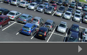
Parking has become a significant issue for many councils across the country. The increase in the number of cars per household, along with constraints on developing land for parking purposes, and the increase in commuters parking near stations with access to large cities has meant that many need the advice of a professional parking expert who can survey and report on the thoughts and concerns of everyone involved.
Parking case study: Manchester
A Bill currently working its way through Parliament is designed to prevent drivers from parking on pavements. In large cities like Manchester where space is at a premium, pavement parking can certainly be a problem – but if it is banned, where will drivers park instead? Council parking policy is usually to ensure that sufficient parking is available for all, that residents’ right to park near their homes is protected, and that parking is not allowed where it will be dangerous or cause congestion for other road users.
In an urban setting, parking on pavements happens in a number of places:
Residential areas where no off-street parking is available
Roads near to rail stations, tram stations or other public transport links
Town centres where parking charges may be high and provision of free parking is low
Industrial estates where parking spaces are insufficient for the number of workers
Pavement parking causes a range of difficulties, particularly for those who need to use the full width of the pavement safely, including those with disabilities, those with guide dogs, parents with pushchairs and more. Reports from Manchester suggest that poor parking often pushes pedestrians on to the road, with all the dangers that entails.
How can things improve?
Parking on pavements has been banned in London for several decades, and councils use a variety of tactics, including numberplate recognition to identify and fine anyone breaking the law. Should the ban extend to other towns and cities, it may provoke a council parking policy review, to determine the impact of a pavement ban, and how to accommodate those road users elsewhere.
Parking surveys from RDS
At Road Data Services, we have the expertise and understanding to conduct full parking surveys to help you understand the habits of drivers in your area, the potential problems parking can cause and to supply the data to help you plan for the future.
Our surveys can be designed and run as stand-alone projects, or in conjunction with our other services such as journey time or traffic count surveys – giving you a complete picture of the road use in your area.
To find out more, please contact us today.
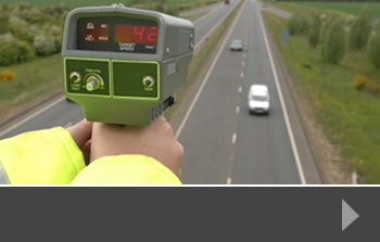
Speeding is a real problem on our roads – both urban and rural. Many drivers break the speed limits – particularly in 30 and 40mph zones – and the police use both fixed speed cameras and mobile speed units to monitor and control particularly difficult areas. In addition, long-term measures such as installing speed bumps to calm traffic can be used to reduce vehicle speed.
Of course, one of the reasons drivers speed is to get to where they are going as fast as possible. For many, this is because over-crowded roads, poor traffic planning and road works and repairs slow journeys down.
Do speed camera tickets work?
The Association for Chief Police Officers’ (ACPO) Speed Enforcement Policy Guidelines have been in place since 2011 and cover a period up to and including 2015. The guidelines observe that: “When a road looks and feels like the speed limit experience shows many will comply.” So in a heavily built-up 30mph area with schools and shops nearby, drivers are less likely to exceed the speed limit than on a road where there is little housing or building and no pedestrian activity.
The ACPO report says that policing speed limits is expensive, and signage should always be clear and appropriate, making it obvious to road users that compliance is expected. It also says that clear speed limits produce the following benefits:
Reduced casualties, both in terms of numbers and severity;
Reduced demand upon the Health Service;
Reduced conflict between motor vehicles and other road users;
A calmer and more free-flowing traffic environment; and
Improved quality of life in local communities
How do we control speed?
Police and local authorities tend to look for ways to reduce speeding without using additional manpower. These options include:
Lowering the speed limit where appropriate
Installing traffic speed humps
Adding traffic calming solutions
Installing speed cameras
If a section of road is particularly prone to speeding drivers, the police may set up a mobile speed unit either as a preventative or punitive measure, and most drivers who receive a speeding ticket will improve their driving as a result.
Traffic speed monitor surveys from RDS
Talk to us about our speed surveys and how they can help you to gather independent data on speeding in a particular area. We can also help with journey time surveys, so that you can see how and where to improve road conditions to promote smoother journeys and more reliable journey times.
The increase in complaints from parents and residents about how traffic and road conditions link to potential dangers to schoolchildren is becoming a real issue for those in charge of highways.
At key periods during term time – usually between 8.30-9.00am and 2.15-3.30pm – roads around primary and secondary schools become jammed with parents dropping off or collecting children. This not only creates potential danger zones for the children, but also interferes with the smooth flow of traffic in the area.
Surveying local road traffic conditions
Local papers often report on campaigns for safer roads near school – whether it’s parking, turning or speed issues. Local traffic conditions vary from one school to another and because many older schools have been extended to cope with intake demands, road systems have to handle increased traffic without any changes to the road or to school access.
Councils responsible for road traffic control can use traffic and parking surveys to learn more about the way roads around schools are used. These surveys collect a wide range of data, including peak travel times, vehicle counts, speed data and parking locations and figures. In addition, pedestrian surveys and journey time data can give a wider view of current conditions, allowing councils, schools and developers to work together to improve travel for road users and make the school run period safer for children.
What traffic calming measures do councils add?
The key for the safety of children is to reduce traffic speed, so councils often introduce 20mph limits in a fixed zone outside schools. They may also install speed bumps, or alter the layout of the road so that drivers have to slow down to navigate. Painting signs on the road may also contribute to speed reduction as will fixed road signs.
Parking may be trickier. Some areas have resident-only street parking next to schools, whilst nearby businesses may restrict parking to customers only. Schools could encourage parents to park slightly further away from school and walk the last 5 minutes of the journey.
Specialist speed surveys from RDS
At Road Data Services, we specialise in collecting and reporting data that promotes informed decision making. Our surveys include speed, journey time, parking, pedestrian and queues, allowing you to tailor the survey and data to your specific needs. Using the information we collect, you can see how to alter or build road systems or introduce traffic calming solutions to make journeys smoother and people safer.
To find out more, contact us today.
In November 2014, Prime Minister David Cameron announced that the government will be spending £15bn on UK road improvements to improve distance and travel times from some of the country’s traffic hotspots.
Speaking to the Confederation of British Industry (CBI) at the end of last year, Mr Cameron identified several projects where driving distances and time were causing problems, including routes across the Pennines, the A1 north of Newcastle and the A27, which runs along the south coast.
Collecting Journey Data
Quality of data is a key factor in deciding where the new money is best spent. Whilst the areas identified all have anecdotal evidence of time and distance problems, accurate, reliable information will be needed to plan and implement any improvements – and that means collecting tightly defined information. Journey times are extremely important for commuters, general travellers and particularly for haulage firms, all of whom will welcome the additional funding for road improvements.
Going the distance for travel time
In his speech, Mr Cameron said:
“In the ‘50s it took us eight years to design and build the first 50 miles of the M1. Today it can take that long just to widen one section of a motorway. So we are speeding things up.
Since we came to office we haven’t just announced a load of road and railways schemes, yes – we have actually got diggers on the ground on the A23, the M62, the M4, M5 and M6. What’s more it’s our ambition to cut the time it takes to upgrade our roads in half. So we are determined to dismantle some of the procedures that have been slowing us down and slowing you down.”
Driving time and distance surveys from RDS
At RDS, we can devise, implement and report on journey times, giving you the opportunity to convert information which you can use for planning, development or proposals to improve your road system.
We can plan a journey survey in conjunction with speed surveys and traffic count surveys to give you a clear picture of what’s happening on the roads that concern you most. To find out more, contact us today.
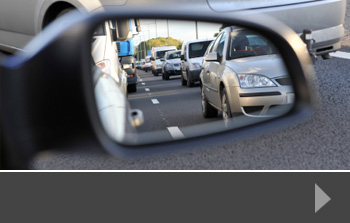
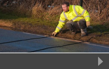
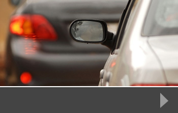
Our Surveys
We carry out all manner of surveys; to find out more about our individual services contact us for a no-obligation quote today or please click on the images below.
With the ability to work across the UK, we offer:


Recent News
News
Will new housebuilding plans have knock-on effect on traffic congestion?UK Traffic Inches Up in 2024 – Data Underscores Growing Demand for Robust Survey InsightsWill new housebuilding plans have knock-on effect on traffic congestion?
New national data show that traffic volumes on Britain’s roads increased in 2024, reaffirming the …
News
Will new housebuilding plans have knock-on effect on traffic congestion?
On July 25th, Levelling Up Secretary, Michael Gove, announced an update to the …