
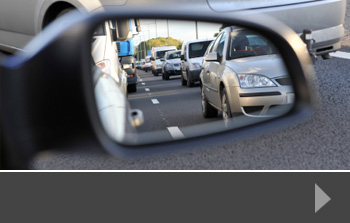
How traffic surveys could be integral to transport planning
It’s often been said that one of the biggest problems with transport planning in the UK is that various parts of the country are disconnected from one another. This means poor communications and a lack of consistency across the network.
The thing that could bring all these disparate elements together is a national transport plan. It’s something that’s been on the wish lists of regional planning groups for some time and a recent government white paper on house building pledged to align infrastructure spending with the Housing Infrastructure Fund.
The Housing Infrastructure Fund is worth over £2bn and targets those areas with the greatest housing need. The white paper suggests that, in order to encourage the delivery of new homes in these areas, infrastructure projects such as transport and utilities upgrades should be funded alongside house building.
What’s more, with other transport links underway, such as HS2, a greater emphasis on more usable public transport, and predictions about the escalation in the number of road users despite additional public transport alternatives, it is becoming crucial that the road network is upgraded and extended to reduce congestion, improve journey times and increase safety.
Why traffic surveys help
Whether existing road systems are changing or new roads being introduced, a range of reliable data is needed to help with design and planning decisions. A variety of traffic, journey and road-user surveys are needed in order to assess existing road use and provide the information from which planners can predict the impact of changes to the system.
This is particularly important in the case of housing developments, where often hundreds or even thousands of new homes are built in a single area, increasing the potential road traffic significantly. A professional traffic survey uses the latest equipment to survey and collect data in whatever format is best for the client. Traffic can be surveyed across a range of days, times and conditions, giving a full picture of road usage and having a significant influence on the decisions that are taken at the planning stage.
Traffic surveys and more from RDS
At Road Data Services, we provide a wide range of transport and road-user related surveys, including pedestrian surveys and parking data. To find out more about how we can help you with your next transport planning or development project, please call us today.


Understanding more about how traffic uses our road system and how we can plan transport to reduce congestion could help towns and cities across the UK to lower the amount of pollution. Traffic surveys are a key way to take stock of current traffic volumes and journeys, and the data they produce can influence planning and infrastructure decisions.
Why is air pollution important?
Earlier this month, the European Commission issued a warning to the UK government about the levels of nitrogen dioxide in the air in cities including London, Leeds, Southampton and Glasgow – showing that the problem stretches the length of the country. The Commission says that poor air quality contributes to the early death of up to 400,000 people in the UK every year, and that the government is failing to deal with the problem adequately. And we’re not the only ones – the Commission has also sent similar warnings to the governments of Germany, France and Spain.
How can traffic surveys help?
Air pollution is caused by a number of things, and it is generally accepted that, in our cities, traffic has one of the biggest influences on air quality. Reducing the number of vehicles within a city, using electric vehicles rather than diesel-powered ones and encouraging people to walk, cycle or use public transport are all strategies used by local authorities to help reduce both pollution and general congestion, and it’s here that surveys can play a vital role, allowing you to see:
- Traffic counts at peak and off-peak times
- Numbers and types of vehicles using any given road
- Journey times on specific routes in and out of the centre of a town or city
- Traffic flow around specific junctions, motorway intersections or developments
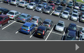
- Parking issues in and around key areas such as public transport stations, business parks, shopping centres and residential developments
Designed to collect data in the best form for the research taking place, traffic surveys produce valuable information for decision-makers. As strict controls on air pollution are enforced, and governments and local authorities are put under more pressure to improve conditions, data on these issues will become increasingly valuable.
Traffic surveys from RDS
At Road Data Services we specialist in a range of surveys for planning authorities, local and national government agencies and private developers. Our surveys are tailored to each individual project and carried out using the latest technology to ensure accuracy. To find out more about how we can help you understand traffic and pedestrian movement in your area, contact us today.
Usually, a traffic survey, pedestrian, journey or speed survey is part of a wider project – either a development or a consideration of changes to the road system, or an investigation into a specific problem. From motorways to school parking; new supermarkets to much-needed housing developments, the traffic survey plays an important part in decision making.
Commissioning a survey
Transport planners, developers and local planning authorities are just some of the bodies who need good quality data in order to make the best decisions. It is likely that they will commission a range of surveys – particularly for a large or complex development – of which traffic is just one. However, as parking, congestion and safety are often some of the biggest concerns at the planning and local consultation stage, it’s important to gather as much relevant and timely information as possible.
So the first step is to talk to an experienced survey firm, which has the right technology to conduct the type of survey you need, which can help you to design and set the parameters for your survey and which can provide the data in the format you need. The survey might take place in a single instance, or may extend over several key periods in order to provide the range of data you need.
Using a traffic survey
The results from your survey will help to influence what happens next, and allow you to produce data that supports your decision process. This might include revising your plans to add pedestrian crossings, design traffic calming measures, change the way traffic is managed for access to your development, or to demonstrate that your changes will positively influence traffic and pedestrian safety.
You might also want to commission compatible surveys – so a pedestrian survey or journey time survey which, when combined with a traffic survey give you a much fuller picture; or it may be useful to undertake a traffic survey once your development is finished, or highway changes have been put into place, to allow you to gather real-time data on the impact of your plans.
Traffic surveys from RDS
At Road Data Services we work with a wide range of parties across all sorts of planning and development projects to ensure decisions can be made with the benefit of good quality, reliable data. To find out more about how we can help with your traffic surveys, contact us today.
A recent analysis of government traffic survey detail has shown the places across the UK where it is statistically most dangerous to drive. The figures, which were reported in ChronicleLive, an online newspaper for the North East, show that Newcastle is third only to the London borough of Hackney, and Tameside in the North West in terms of accidents between midnight and 4am.
Using statistics to influence travel planning
Whilst the percentage of accidents reported in this four-hour period is small in comparison to the overall accident statistics for each area, it’s clear that some places suffer more than others. Nearly 7% of road accidents – 53 incidents – recorded by the Newcastle police force in 2015 occurred post-midnight, compared with a national average of less than 4%. Causes of accidents vary, but it is likely that drink drivers cause accidents at night time more often than during the day, and that quieter roads often encourage speeding and reduced awareness, which can result in accidents, including fatalities.
Understanding how many and what type of accidents happen at certain times of the day and night can help to influence traffic planning. Any stretches of road identified as particularly dangerous can be modified using traffic control measures, such as speed limit reduction and chicane-style road improvements, or monitored using traffic cameras.
Traffic surveys for development planning
It’s also worth looking at traffic survey statistics for night-time accidents when planning a new development. If an area has a higher incident of accidents at night, planners and road safety experts may want to investigate the reasons before siting a housing development or school in that area. The greater the understanding of the way the roads are used by traffic and pedestrians in a certain area, the better the resulting development is likely to be.
Traffic, pedestrian and journey time surveys from RDS
At Road Data Services, we support planners, developers, agencies and other interested groups with accurate data generated by our bespoke surveys. We work closely with you to identify the best times to conduct the survey, and to ensure data is provided in the right format for your needs. Our work is used to influence and inform a wide range of road, traffic, parking and development issues across the UK.
To find out more, or to talk to us about providing reliable data for your next project, please contact us today.
The government has recently announced a consultation on various issues which may be affected by the introduction of driverless cars in the next three to five years. As driverless technology becomes more widely available, the government is aware that it will need to be prepared both practically and legally for any changes that might happen. In addition to formal consultations, there may be a need for traffic surveys to look at current road use and journey safety.
Updating the Highway Code
The introduction of certain driverless technologies will require a revision of the current Highway Code, to ensure that a range of manoeuvres – from motorway lane-changing to reverse parking – take into account the way that these new cars may operate. It may also need to include guidance on the driver taking over operation of the car: there should always be a qualified driver in the car who can take control at any stage of the journey.
In addition to the rules of the road, it is likely that the insurance industry will need to update its policies. How is responsibility allocated if an accident is caused by a driverless car? Insurers are already planning for the increase in driverless technologies, and watching carefully those countries where trials are taking place – particularly America where two fatal accidents involving driverless cars are likely to test current legislation.
And whilst the government is not considering repealing any existing road safety laws, there may be a case in the future for allowing drivers to, for example, use their phones in the car if the driverless technology has taken over.
Online consultation for drivers
The government has set up its consultation online so that anyone can log on and have their say. It wants to find out what road users of all kinds think about the introduction of driverless technology and how the UK can maintain a safe, reliable and free-flowing road system as far as possible.
Transport Secretary Patrick McLoughlin said: “Driverless car technology will revolutionise the way we travel and deliver better journeys. Britain is leading the way but I want everyone to have the chance to have a say on how we embrace and use these technologies. Our roads are already some of the safest in the world and increasingly advanced driver assist and driverless technologies have the potential to help cut the number of accidents further.”
Traffic surveys that enhance the consultation process
For traffic, pedestrian, parking and road use consultations of all kinds, talk to RDS about our range of surveys. From simple traffic surveys to automated traffic counts, journey time surveys and pedestrian surveys, we have the experience and skills to conduct professional, targeted investigations, delivering the data in your preferred format. Our data has been used to inform debate and influence outcomes.
To find out more, or to talk to us about your next project, please contact us today.
It’s one of the most emotive road safety issues of our time: how to keep children and other road users safe at school drop-off and pick-up times, when traffic is busy, and drivers often distracted. The AA Populous Motoring Panel traffic survey for April 2016 found that 57% of those surveyed who had school-age children said that there is often traffic chaos near the school their children attended.
There are a number of ways that surveys could help to ease traffic problems at these vulnerable locations. Both traffic and parking surveys can be used to collect and analyse data on the quantity of traffic using the roads at key times – and compare them with the volume at off-peak periods. And because parking is often one of the reasons why traffic gets so quickly snarled up around these times, it makes sense to look at parking options, including providing dedicated parking, offering rolling drop-off times so that children aren’t all coming to school at the same time, and imposing parking restrictions around the immediate vicinity of the school, so that roads and junctions are kept clear.
These types of traffic volume study and parking analysis can be used to inform changes to the road system, and to demonstrate the impact of further developments in and around the school area, including increasing the pupil intake at the school, and building new housing developments nearby. Local planners may also choose to put in traffic calming measures such as priority lanes, speed bumps and lower speed limits, to encourage safer and slower driving. In addition, for those schools with a wider catchment area, traffic surveys can help to boost plans for additional bus services, helping to reduce the number of cars travelling to school at any one time. Match this with car-share schemes, encouragement to walk or cycle to school rather than travel by car, and even diverting non-school traffic from nearby roads at key times, and it’s easy to see how good quality data can help to influence positive road safety changes.
Bespoke traffic surveys from RDS
At Road Data Services, we specialise in collecting a wide range of traffic survey data, parking, pedestrian and journey time data, using a range of reliable methods. These result in good quality data that can be reported in the way that’s best for your project, helping you to make a strong case for a change in the existing road system, plans to develop or create new road systems, or just to show that the current system is actually the best one for the circumstances. To find out more about how we can help, just contact us today.
A range of recently approved road and vehicle technology projects could help to improve road traffic conditions in years to come, and influence the way that traffic and parking surveys are undertaken.
Everyone is aware of Google’s driverless car programme, and a range of road car manufacturers are also researching and implementing technologies into their vehicles that remove some operations from the driver, in a series of steps that could lead to completely driverless travel in the future. These systems are designed to make travel safer, resulting in greater road traffic control.
The most recent projects to be supported by the government include technologies for both road and rail systems. For example, around 40 miles of existing roads in Coventry are to be equipped with systems that will aid so-called ‘autonomous’ vehicles. These talking technologies will be able to alert drivers of accidents ahead and receive details of hazards in the area.
Other projects to receive government backing include ways to reduce the cost of testing driverless technologies, surveys that improve manufacturers’ understanding of what drivers are really looking for from the technologies, and technology that monitors vehicle data to predict safety risks.
The congested nature of today’s traffic and road conditions link with a desire to make driving easier and safer so that, rather than adding more road traffic calming measures to our streets, the vehicles themselves become part of the solution, not part of the problem.
And how will this impact traffic survey work? It’s possible that driverless cars may be able to continuously send data back to the manufacturer or to a nominated survey source so that accurate and real-time travel data can be collected. This, merged with survey data taken in more traditional ways will help road planners, developers, manufacturers and safety campaigners see exactly what impact the new technology has on congestion, journey times and general road safety.
Traffic surveys from RDS
At Road Data Services, we specialise in a range of surveys using the latest technologies. Our knowledge, understanding and analysis allows planning departments, transport consultants and developers of all types see exactly what impact new developments or changes to road systems will have on the travelling public, and to implement systems and changes that ease congestion and improve safety.
To find out more about our work, or to talk to us about your next project, please contact us today.
It’s becoming increasingly important that traffic and transport planning techniques and decisions are made on the basis of accurate and relevant survey data. With increasing numbers of vehicles on the roads, new housing, business and retail developments underway across the country and continued dissatisfaction from road users about traffic congestion, having the right information can make the difference between successful road development and an expensive failure.
Transport planning support
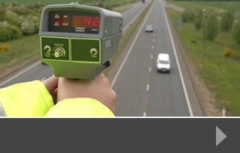
People involved with the transport planning process know the value of this data. Understanding all the aspects of the way the road system is currently used helps to influence changes or additions, and planners, engineers and transport specialists use a range of traffic surveys to determine a variety of issues, including:
- The quantity of vehicles using the roads at specific times
- The type of vehicles using the roads
- The speed of vehicles on the road
- The use of roads by pedestrians
- The journey times of vehicles using the roads
- The effect of parking availability and restrictions in the area
- The amount and effect of queueing traffic in the area
Knowing the starting point as far as the road system is concerned, allows transport planning and engineering professionals to look at the potential impact of road changes, speed restrictions, traffic calming, bus lanes, new developments, school provision and a whole host of other measures that affect the day-to-day life of the community in question.
Traffic surveys and the transport planning process
When plans are submitted for planning approval, it is often the potential impact of additional traffic or changes to the road system that prompts opposition and objection. This is particularly the case when there is a perceived impact in residential areas or around schools, where there may already be traffic-related issues. It makes sense, then, for local authorities, developers and planners to have access to accurate data that shows exactly how the roads are being used and can demonstrate that new plans may make a positive difference.
Reliable traffic surveys from RDS
Whether for national schemes or regional transport planning, Road Data Services can supply accurate survey data across a range of variables, from traffic count to road-user interviews. We use the latest technology to capture data, supplying it to you in the format that works best for you. Ask us for our help and advice on your planning project and see how our results can help your scheme be successful.
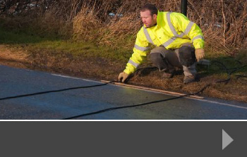
A current problem in the West Sussex town of East Grinstead has highlighted the potential need for traffic surveys and journey time data ahead of planned major roadworks or utility upgrades.
An East Grinstead town councillor has said that the town is experiencing traffic queue chaos because traffic lights have not been properly synced by Surrey County Council on one side of the county border and West Sussex on the other. This, he says, combined with the independently-controlled traffic lights at the roadworks themselves has caused huge problems.
Road and traffic services always need to plan works as far in advance as possible and, for long-term or particularly disruptive works, it is always worth commissioning a range of data collection, including traffic volume study information and traffic and parking surveys. These can help to identify the volume, type and intensity of traffic during normal road operation, helping contractors to plan ahead, seeing how diversions and traffic light timings can be altered to help keep the roads moving.
A detailed survey will cover a number of agreed areas, which might include vehicle classifications, video data capture, journey time analysis and any other data that planners feel may help to improve road and traffic safety for the duration of the road works.
Why use a traffic survey?
Apart from gathering important data that helps project managers to plan ahead, traffic surveys can also help to build better relationships between councils, road repair and utility contractors and the travelling public. Seemingly simple solutions like syncing traffic lights to take account of other junction systems elsewhere, or changing lights in accordance with the time of day and volume of traffic will all contribute to minimising disruption and making journeys as easy as possible.
Traffic Surveys from RDS
At Road Data Services, we design, implement and report on traffic volumes, journey times, parking and much more. Gathering data and reporting exactly how you need it, we use the latest technology and our years of experience to enable you to plan more efficiently, whether you are involved in town planning, retail development, housing development or road and utility improvements.
To find out more about how we can help, just contact us today.
A £29m transport improvement scheme has been approved by the City of Lincoln Council’s Executive, following wide-ranging discussions with partners, a public consultation and the results of various surveys about the current transport situation.
The plans include demolishing the existing bus station and building a larger, modern bus station next to the train station. Existing pedestrian and platform footbridges will be replaced with a dual-function bridge and a new multi-storey car park will be built, accommodating 1,000 vehicles.
Using a range of traffic and transport planning techniques and approaches, there will be upgrade work to the highway at the front of the railway station, making additional space for cyclists, and fulfilling the Council’s vision of a new, modern transport hub for the city.
Schemes of this size need a range of transport planning support services in order to ensure that all the details are in place and that proposals reflect the way public and private transport is currently used, and how usage might change over time. This is where survey data plays its part. From traffic surveys to parking information, the data collected by professional survey teams helps to give a clear picture of any problems or issues, allowing planners to see how and where transport and highways can be improved. This is particularly important in a project the size of Lincoln’s where significant changes are being proposed.
Leader of Lincoln City Council, Councillor Ric Metcalfe, said: “A new, fit for purpose transport hub is vital to ensure the city’s economic future and this is a hugely important project for the people of Lincoln, in addition to visitors and businesses as well.”
“It’s therefore essential we do everything within our power to progress this much-needed project, which will ensure the vitality of our city centre. An integrated transport interchange in the heart of the city to serve residents, businesses and visitors, achieving the growth the city needs.”
“The city is in dire need of a new, modern bus station, able to cope with increased passenger numbers and opening up the possibility of more services in the future.”
“It’s also worth noting this scheme would also complement the county council’s East West Link Road and Network Rail’s new footbridge in the High Street to create a more accessible, welcoming and functioning city centre.”
Traffic Survey data from RDS
Our bespoke traffic surveys are designed, implemented and reported by us, so you can be confident you’re getting the best data for your needs. We work with local authorities, county councils, private companies and developers to provide clear information that influences good planning policies. To find out more about how we can help with your transport planning process, call us today.