
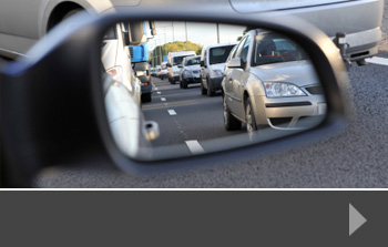
Are car-free Sundays the way to fuel prices?
With the price of fuel at the pumps still at eye-wateringly high levels, motorists are looking for ways to save money and perhaps refill their cars less often.
There are a variety of ways you can help to manage your fuel efficiency, and data from traffic surveys suggests that some of these might also help ease congestion and journey times for drivers on the roads. Here are some top tips:
Reduce your driving speed – this is particularly true for motorway driving. According to a report by the International Energy Agency, reducing your top speed by just 6 miles per hour could help to reduce consumption. It might also help with traffic flow, which in turn will reduce heavy braking and make a further impact on your fuel use.
Take heavy things out of your car – we tend to drive around with all sorts of things in the back seats and the boot. But the heavier your car, the more fuel you will use. So take a look at what you can do to reduce the weight you’re carrying. The same applies to roof boxes and removeable roof bars – they cause drag, which in turn burns more fuel.
Check your tyre pressure – when your tyres are soft, there’s an impact on the amount of fuel you use. So always check your tyres are pumped to the recommended levels, especially if you are going on a longer journey, or travelling with a full vehicle.
Keep your eye on the traffic – this might seem obvious, because we are always looking at traffic conditions, but you will be more fuel-efficient if you reduce the ‘accelerate-brake-accelerate’ way of driving and instead drive more smoothly to the conditions ahead of you.
Turn off your air conditioning – using your AC system uses engine power, which in turn uses fuel. So unless you really need it, turn it off.
Try car-free days – as part of the International Energy Authority’s suggestions for reducing oil demand, it suggested that cities implement ‘car free Sundays’. This would automatically reduce the amount of traffic on the roads and encourage people to either stay local, or use public transport. You can also implement your own car free days – perhaps by working from home, or planning your day so that you can walk or use public transport a couple of times a week. You might be surprised at how much longer you can go between filling up – and it should help your budget too.
To find out more about traffic volumes, congestion and journey times on the road network, talk to Road Data Services about our traffic surveys and other data collection services. We can help gather the data that informs better traffic and road network planning.


National Highways – formerly Highways England – has launched a scheme aimed at helping young people understand the challenges and successes of building the next generation of transport links. The scheme, which is based around the popular game Minecraft, lets students see what it takes to design, plan and build a successful road scheme.
Encouraging STEM subjects
By its nature, the National Highways scheme encourages the core subjects of science, technology, engineering and maths, and it also pays significant attention to the importance of protecting species of flora and fauna, and maintaining biodiversity. So students may come across scenarios where they need to identify important animal habitats and work out how to plan a road system that avoids them.
They also have to take into account other issues, such as managing archaeological sites, protecting our history as well as our current environment. And, of course, there is a focus on the next generation of engineering, including the machines used to build tunnels, and how to use more sustainable materials. These are all represented by a range of different games, based on actual road projects happening now, including:
- Signs game based on the Lower Thames Crossing
- A303 Stonehenge – through the ages
- Natural habitats at the A428 Black Cat to Caxton Gibbet improvements
The project also explores a number of careers relating to the road transport network, including Ecologist, Engineer, Tunnel machine operator, Designer, Welder and Archaeologist.
One of the teachers using the National Highways game system said: “We’re looking at archaeology, engineering, and sustainability in the game. This has broadened their understanding of what goes into building a road.”
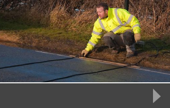
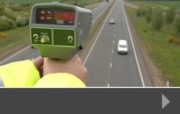
Traffic surveys supporting road improvements
Part of the planning and design of road improvements or new road building is having accurate data about current conditions, journey times, parking availability and congestion. This data is often used to make arguments for widening of existing roads, extension of road networks or new building. And this data is best collected by accurate traffic surveys and other surveys that give a clear picture of what’s happening right now.
At Road Data Services, we have years of experience in traffic surveys, helping developers and planning committees make informed decisions about changes or updates to the road network that will bring long-term benefits to local communities and economies. To find out more about how we can help, just contact us today.
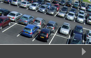
Before the pandemic, local authorities and developers were paying a lot of attention to parking. With councils trying to reduce road traffic into city centres and encourage cycling, walking and public transport as an alternative, drivers were seeing pressure on parking spaces – together with increased parking charges. Businesses with their own car parks were encouraging car sharing or only allowing drivers to park on site on three or four days a week.
During the pandemic lockdowns, of course, many people weren’t travelling to work at all, so car parks largely stood empty. In the USA, authorities even commandeered parking lots to provide temporary camp areas for the homeless.
But today, we are being encouraged to go back to the office if we can – and one of the ways we feel we can ensure a safer journey to work is by taking the car – and they are far less likely to car share than they would have been pre-2020. So parking may become an issue again.
And it’s not just city centres where parking is a problem. Developers of any kind of residential, retail, commercial or mixed sites also have to consider access and parking.
Parking as part of planning decisions
When we undertake parking surveys, the data we collect are used to inform decisions about new developments or changes to existing building use. Parking is part of a much wider planning and development debate – it needs to be talked about within the context of traffic management strategies, low-emission zone plans, local economic development and individual local plans.
Some of these, of course, are long term plans. The move to encourage people to use other methods of transport requires investment in those other methods as well as significant input into behaviour change, so that people feel that public or self transport is safe, affordable and easy to use. In the meantime, people are likely to continue using their cars and will require good quality, secure parking whether they are in the city centre or in newer out-of-town developments.
If you need to revisit the parking options in your area, or you need clear and reliable data for planning and development decisions, talk to us today about our parking survey services. We can help you make the decisions that further your long-term plans as well as providing shorter-term solutions.
National Highways – previously Highways England – has released details of its new Digital Roads plan, which it says is a revolution in the way the strategic road network will be planned. Its desired outcome is to enable safer journeys, faster delivery of road projects and better value for taxpayers.
The plan – which you can see in full here – is split into three core areas:
- Design and construction
- Digital operations
- Digital for customers
These areas will help the government to meet its targets for 2025, which include:
- Enabling design by using digital tools. This will apply to road scheme designs and long-term planning.
- Better practical design approaches – using modular construction and modern fabrication methods will help to standardise road design and improve safety.
- More efficient construction practices, including using automated systems where relevant and safe.
- Using data to manage the network more effectively, including planning roadworks and closures, and managing traffic safely.
- Network flexibility will be improved by having better real-time information available.
- Better information for staff – National Highways teams will have access to the latest information, informing better decision making and planning.
- More accurate and consistent information for road users.
- Improved customer information and better customer service.
- More informed and engaged partnerships with the agencies and companies that work alongside National Highways, to ensure that new and upgrade schemes run smoothly and to schedule.
“We are at the beginning of a digital revolution in roads infrastructure and expect to see more change in the next decade than we have in the last century,” said Nick Harris, Chief Executive of National Highways. “This provides an opportunity to make our roads safer, improve customer experience for all, and support our plans for net zero.”
What does this mean for road users?
We are used to major road schemes – repairs, updates and new roads – disrupting our journeys; particularly on motorways and A roads. These schemes can take many months to complete, and if they fall behind, can cause increasing economic problems for companies relying on road freight.
A good outcome for the Digital Roads plan would be for road users to see well-planned and communicated infrastructure schemes that are managed so that traffic flow continues, stick to scheduled timescales and noticeably improve the network once they are complete. In general, if the Digital Roads plan can also deliver enhanced safety across the road system, drivers will feel more confident behind the wheel.
Traffic surveys from RDS
At Road Data Services, we assist road network planning by delivering highly accurate data on traffic congestion, journey times, parking issues and more. Our work is used by planners and developers around the UK to help them make informed decisions about the projects they are working on.
To find out more, contact us today.
Last week’s government announcement about the change to the eastern leg of HS2 and Northern Powerhouse Rail may have a knock-on effect on road traffic in the affected regions. Original plans were for a high-speed line between Birmingham and Leeds, connecting the north east with HS1, whilst the Northern Powerhouse Rail was intended to be a direct high-speed line between Manchester and Leeds via Bradford – which is currently the largest UK city not connected to mainline rail.
Managing current traffic
Surveys show that, now people are travelling more, traffic levels are rising and congestion is still a problem on many routes in the areas where high speed rail may have made a difference. For people commuting from Leeds or Liverpool to work in Manchester, for example, trains are too slow, irregular or crowded, forcing many to choose to take their cars instead. This has a knock-on effect on air pollution, general emissions and road safety, and puts considerable strain on parking availability in cities that are determined to reduce the amount of road traffic coming into their central areas.
For Leeds, a city that was expecting to benefit from better rail connections, and which launched a Clean Air Zone in 2020 that made a significant difference to the air quality in the city, the government has suggested it will fund a tram system, similar to those in Manchester, Sheffield and Nottingham. However, whilst this will support local travel and potentially help to reduce traffic coming into Leeds city centre, it doesn’t address the issues of trans-Pennine travel, and so commuters from outside the tram zone will still need to look for other ways to get into the city.
Potential traffic effects
Cities are working hard to reduce traffic, encourage public transport, walking and cycling and generally improve transport options for people living and working in their areas. Continuing to run traffic surveys on the busiest routes in the region now affected by a potential reduction in the rail service will allow developers and planners to see what, if any effect the new plans will have on road traffic and how they can mitigate the potential risks to environment and air quality.
Traffic surveys from Road Data Services
We work with local authorities, developers and researchers, producing accurate traffic, parking and journey time data that helps to inform positive decision making. Contact us to find out more about how we can help.
At the end of the summer, National Highways – the new brand for Highways England – launched an online feedback programme to encourage road users, and people who live near to major motorways and routes in England, to have their say.
The findings from this consultation will have an impact on the future planning of investment in the road network. National Highways is currently responsible for around 4,300 miles of roads, including motorways and major A road routes.
The tool – which you can find here – gives you the option on feedback about a specific section of motorway or A road, or a particular journey on these roads, or general feedback. Issues you can give your opinion about include:
- Safety
- Congestion
- Interaction with local roads
- Environment
- Facilities
There’s an opportunity to include references to data, studies or other evidence to support your opinion. An interactive map allows you to highlight the area of road network that you are concerned about.
Consultation includes traffic surveys and more
As well as collecting information and feedback from road users, the consultation will take in professional bodies, businesses and campaign groups, so that National Highways has a wide range of data to inform its decisions. This can include traffic survey and other data collection that shows particular areas of congestion, journey time delays or access problems.
Speaking at the launch of the online tool, the Executive Director of Strategy and Planning at National Highways, Elliot Shaw said:
“At National Highways we are constantly challenging ourselves to seek out ways to improve the experience of those who use our roads and the communities who live nearby. The new easy-to-use online tool provides everyone from commuters, professional road users, nearby residents and community groups to comment.
I urge you to provide feedback on what is important to you – a specific location on England’s motorways or major A roads, a longer route or general feedback about our road network. This is your opportunity to help inform the long-term vision for the future of our roads.”
Traffic survey data from RDS
At Road Data Services, we help planners and developers see the potential impact of changes to the road network around them. Our surveys collect precise data that informs decision making. We can manage anything from ANPR surveys and parking surveys to automatic traffic counts – collecting vital information for your project. To find out more about how we can help, contact us today.
A couple of months ago, we previewed some of the potential changes to the Highway Code, part of which was being based on a survey and public consultation. The government recently announced that both pedestrians and cyclists will have greater priority in certain situations when the updated Code is published in the autumn.
What will change for pedestrians?
Surveys show that people have increased their walking and cycling activities during the pandemic, and the government wants to encourage more of this activity as part of its targets to reduce road traffic. In fact, there is a commitment of £338 million pound fund to support these targets. So, cyclists and walkers are now going to get more priority over cars at junctions and crossings, according to a report by the RAC.
At the moment, vehicles only have to stop for pedestrians when someone steps onto a crossing, and pedestrians are advised not to step out into the road at a crossing until vehicles have stopped – this seemingly contradictory advice is likely to remove that guidance, so that cars will need to stop at a crossing if a pedestrian is waiting to cross.
Cyclists will also have priority at junctions when travelling straight across, and there will now be clear guidance in the Code about safe passing distances and speeds. It is hoped that this will reduce the number of accidents involving cyclists and vehicles that pass to quickly or too close by.
The funding for walking and cycling will be used to upgrade infrastructure across the country, including walking schemes and hundreds of miles of safe, high quality cycling lanes.
The Transport Secretary, Grant Shapps has said: “Millions of us have found over the past year how cycling and walking are great ways to stay fit, ease congestion on the roads and do your bit for the environment.
“As we build back greener from the pandemic, we’re determined to keep that trend going by making active travel easier and safer for everyone.”
Traffic and pedestrian surveys from Road Data Services
If you are interested in making your development or road network plan safer for pedestrians and cyclists, contact us today. We carry out bespoke surveys, including pedestrian surveys and parking surveys to help you see where the points of greatest danger may be. Our precise data helps developers and local authorities to plan for the best future for our roads.
On June 30th, a prototype of a flying car made its maiden flight between two airports in Slovakia. The vehicle is a hybrid car and aircraft, called AirCar and has been designed by Professor Stefan Klein of Klein Vision, the company which developed the car. It takes just two minutes and 15 seconds to convert from a car to an aeroplane and has clocked up more than 40 hours in the air to date.
Money in the air
There’s a lot of excitement around the potential market for flying cars, according to the BBC website. It says that, in 2019, consultancy firm Morgan Stanley predicted that the market could be worth up to one trillion pounds by 2040 – that’s less than 20 years away. Flying cars are considered to be an answer to congested roads and the consequent strain on road infrastructure – something we are heavily involved in working on as part of our traffic surveys.
A long way to go
These are very early days in the evolution of flying cars. The AirCar, which is powered by a BMW engine running on regular petrol fuel, certainly looks the part, with a sleek design and narrow wings that fold down the side of the car for road driving.
The car needs a runway to take off, which limits its potential marketability – other innovators are looking at drone-style flying vehicles that can take off vertically. The Aircar can currently only take two passengers with a combined weight limit of 200kg, but it does show what could be possible.
There’s also the sustainability aspect. Does a flying car use more fuel or cause more damage than a traditional car? With a top speed of 170km per hour, it certainly reduces journey times, and so is likely to be more sustainable overall than driving distances at a much lower speed. But there are still many factors to be worked out – not least safety.
Proponents of flying cars are excited by the successful development of the AirCar, but are also aware that there are very different levels of skills required to ‘fly’ a car as well as drive it. And if there are significant numbers of flying cars in the air, how do we make sure there are no collisions? And finally, the vehicles themselves will have to meet stringent safety standards so that everyone is confident they can have a long-enough life span without compromising the safety of people in them – or under them.
To find out more about how we can help your project look at the strain on the road network, or plan for new roads and developments, talk to us today about traffic surveys, journey time surveys and our other services for collecting accurate road-use data.
Our road networks are changing: the introduction of more miles of smart motorway, the use of variable speed limits and increased use of high speed roads all warrant clear guidance for road users in the Highway Code.
Highways England recently announced an update to the Highway Code, working in partnership with the Driver and Vehicle Standards Agency (DVSA). In considering the updates, both agencies opened a consultation process where both road users and interested organisations could contribute their thoughts. More than 3,000 people and organisations took part, and the consequent amendments will form part of an amended Highway Code which will be published later in 2021.
According to Highways England, the new guidance will include:
- clearer advice on where to stop in an emergency
- the importance of not driving in a lane closed by a Red X
- the use of variable speed limits to manage congestion
- updated guidance on key factors that contribute to safety-related incidents, including driving while tired, unroadworthy vehicles, safe towing, tailgating and driving in roadworks
Some of these issues have been raised by users of smart motorways, which have seen several fatal accidents in hard shoulder lanes being used for live traffic, so campaigners are likely to welcome updated guidance for how to use smart motorways safely.
Road improvement schemes
Highways England is also currently managing a number of important road improvement schemes. These schemes are designed to reduce congestion, increase capacity on key routes and improve general road construction. The agency expects the improvements to have a positive effect on journey times for freight, business and pleasure driving, whilst keeping drivers safe and having a minimal impact on local communities.
At the same time, many local authorities are continuing with local road improvement schemes and with other upgrades to facilities for road users, including networks of electric charging points and additional lanes for cyclists. This is especially true in busy towns and cities – many of which have already or are planning to introduce congestion charges – where people are being encouraged to travel more often by bicycle.
All these types of road improvements, including any changes to roads because of retail, commercial or domestic developments, need good quality data to help with planning. From traffic surveys to pedestrian surveys, parking data to journey times, Road Data Services can help local developers and planners to make the best, informed decisions on their projects, resulting in safer roads and reduced congestion. To find out more, contact us today.
Cities are increasingly investigating and implementing low emission zones – or clean air zones – as a way of tackling both congestion and local air quality problems. London has the most prominent charging zones, with both a congestion charge and a low emissions charge, but other cities around the UK have been told by the government that they also need to introduce similar measures.
Along with data collection exercises like traffic surveys, journey time surveys and parking surveys, congestion and air quality management is designed to ensure that the strain on local transport networks are eased, and that people think about the necessity of taking a vehicle into city centres.
What’s happening around the country?
We’ve summarised the current state of play for low emission zones across some of England’s key city centres:
Bath: Clean Air Zone is now in operation. Charges apply 24 hours a day, 365 days a year. Private cars and motorbikes are not charged, even if being used for work. But coaches, buses, trucks and lorries are charged £100, with taxis, minicabs, vans and minibuses paying £9.
Birmingham: The city is planning to launch its Clean Air Zone on June 1st 2021. Vehicles will have to meet the same standards as those for London’s ULEZ if they want to avoid changes.
Glasgow: A low emission zone restricting the movement of older buses was put in place from December 2018. The introduction of extensions to vehicles that will need to pay to enter the city has been delayed until January 2023.
Greater Manchester: The city expects to introduce a Clean Air Zone from spring 2022. The council’s clean air website says: “Vans, buses, coaches, taxis, private hire vehicles, minibuses and heavy goods vehicles that do not meet emission standards would pay a daily charge to travel in the Zone. Private cars, motorbikes and mopeds are not included.
Leeds: Plans to introduce a Clean Air Zone in Leeds have been scrapped by the city council. The scheme was paused in August 2020 because of unexpectedly positive air quality levels. The council is in a joint review with the government to see if the zone is still needed. Polly Cook, the council’s chief officer for air quality, said: “If traffic levels returned to pre-Covid levels, we would still not exceed legal limits.”
Sheffield: A low emission zone has been proposed for older taxis, minicabs, vans and minibuses, but no start date, hours of operation or daily charge has been confirmed. In 2019, Sheffield City Council consulted on a plan for a Clean Air Zone, which would have charged the most polluting taxis, vans, lorries, coaches and buses to drive on or within the inner ring road. These plans are currently undergoing a review to take into account the impact of COVID-19. We will provide an update on our plans as soon as the review is completed.
To find out more about how RDS can help you to monitor, collect data and plan for a better, less congested road network, contact us today.