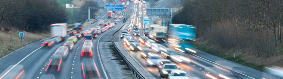
Government proposes new plans for smart motorways
In the long-running saga of safety on the UK’s motorway network, the government recently announced that any new smart motorways must have radar technology in place to make sure that any vehicles that are broken down in the hard shoulder lane can be spotted and assisted.
The announcement comes after a campaign by families who have lost loved ones in accidents on smart motorways, supported by road safety charities and politicians. In addition to ensuring the technology is installed on new stretches of smart motorway, Transport Minister Grant Shapps has also pledged that existing smart motorways will be retrofitted with the technology by September 2022.
Cameras and fines for motorists
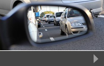
One of the key areas of concern for people who oppose smart motorways is the fact that some drivers ignore the red ‘X’ sign which indicates that a lane is closed. In the instance of a car being stopped on the hard shoulder when that lane is being actively used, the ‘X’ sign is intended to prevent traffic from travelling in the lane. When the signs are ignored, accidents are more likely to happen.
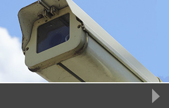
That’s why Highways England has said it will also upgrade cameras to capture images of those motorists who ignore the signs. It will then prosecute those motorists, hoping to create a safer driving environment.
Adding emergency refuge areas
Part of the safety planning of smart motorways is for safety refuge areas that can be brought into use when the hard shoulder is being used as an active lane. According to the AA, more refuge areas are required, so that it is easier for a vehicle in trouble to get off the main lane of the motorway. Recently, it has been agreed that refuge areas will be at one-mile intervals but many campaigners think this isn’t enough.
Reducing congestion
The idea behind smart motorways is to reduce congestion – something that is a problem not just on motorways but on much of the UK’s road network. As lockdown restrictions ease and people begin travelling again to work, shop or leisure activities, we are expecting roads to become more congested. And congestion – or frustration with it – is often what leads to road traffic accidents.
Any measures to combat congestion are good for safety, journey times and air quality. That’s why we are dedicated to providing the data that helps traffic planners and developers make the best plans for local communities and the wider environment. At Road Data Services, we use traffic surveys, ANPR surveys, journey time surveys and more to collect precise data that informs better decisions.
To find out more, contact us today.
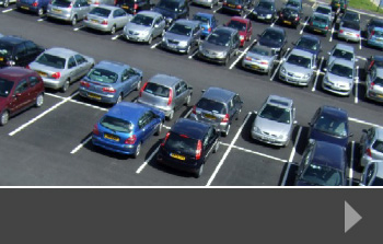


Property development has an impact on road usage, traffic levels and parking. So part of the planning process always involves looking at the impact of the development on the road network and on local services. That usually involves a range of data collection, including traffic surveys, pedestrian surveys and parking surveys – all designed to give a clear picture of the current situation to help planners see what the potential impact may be. These surveys may also be repeated once the development is complete, to provide valuable date for future road or pedestrian upgrades and to inform future decisions.
Will the development market bounce back?
The answer is probably that it depends on the development. The new habits formed by the pandemic have potentially changed the way we work and the way we consume. That means that developments that are focused on the office/retail mix may find the market harder, whilst those investing in ‘essential’ infrastructure like warehousing, industrial property and housing may see more opportunities.
One of the clear areas of change is in the office building market. The pandemic has given many people a clearer idea of how they want their work-life balance to look, and this has resulted in many companies investigating ‘hybrid’ working, where workers can blend working from the office and working from home, alongside fully remote working for those roles that are appropriate for it.
For office developments – particularly in city centres – this means a potential drop in demand, and therefore a drop in the profit the development can make. And similarly, offices on industrial parks may suffer from a change in working conditions and this will have a knock-on effect on the amount of traffic on the road – especially at peak times. So some of our assumptions about the times that are busiest may change. School runs will obviously always be a thing, but they may not be combined with the morning commute.
The overall feeling of property development specialists is that the development market will bounce back and that developers – who are known for flexing to suit the market – will be putting plans in place for developments that suit both the new working conditions that are likely to occur but also have an eye to easy social distancing and lots of outdoor space.
Traffic survey support from RDS
To find out more about how we can help you with traffic, parking and other surveys, delivering precise data that helps your decision making on your current or next development, contact us today.
Even before the pandemic, local authority planners were looking at ways to manage traffic in towns and cities. An environmentally-aware push towards more public transport, walking and cycling, alongside a change in the way we use town centres means that authorities, developers and traffic planners need to be creative when it comes to how our towns may look in the future.
Attracting people to town
Of course, the main purpose of all of this planning is to attract people into towns and cities – both locals and visitors or tourists. Whilst traditional shopping may not be the draw it has been in the past, there are plenty of other reasons for people to take trips to the town – these include food and drink outlets, cafes, cinemas, theatres and live venues and events and entertainment.
How these people will get to town is part of the planning process. Traditionally in the UK, many people drive into towns, so there are often issues to look at in terms of congestion, traffic management, parking and how the road network is shared between general traffic, public transport, cyclists and pedestrians.
The Covid affect
Before Covid was an issue, many local authorities were having great success moving people onto the public transport network. Varies ways of discouraging cars from coming into towns were being trialled, many with good results. However, Covid has changed the way that people think about travelling on buses in particular, where it is harder to maintain social distancing and to clean seats between travellers or journeys.
So now planners have a new problem – how to attract people into town in order to boost economies whilst also understanding and meeting the needs of people who may rather drive into town than use shared transport.
Parking and traffic surveys
In report in mid 2020, national estate agency, Savills published an article on post-Covid planning for town centres. It suggests:
“Taking a pragmatic approach to the requirement for car parking at town centre developments to reduce significantly requirements in order to both acknowledge the accessibility of such locations, existing reduction in private car ownership and the policy requirements to transition towards a low carbon future.”
With an increasing range of requirements from local authorities and national governments for sustainable developments, including access to public transport and reduced road traffic, there is likely to be a demand from developers for up-to-date data on road usage and parking requirements to encourage people to use their town centres more often whilst remaining safe and healthy.
More from Road Data Services
To find out more about how we can help with a wide range of data capture, including traffic surveys, speed surveys and parking surveys, contact us today.
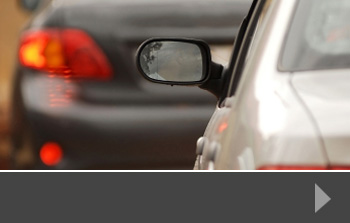
Recent news articles have focused on the potential dangers of smart motorways. These types of motorway have been introduced to large sections of the UK road network, including the M1, M25, M4, M5, M6 and M62 – with other upgrading projects underway. Most drivers are now used to navigating these stretches of road which use flexible lane planning to handle varying levels of traffic. This includes using the hard shoulder as a traffic lane and putting variable speed limits in place.
So, what’s dangerous?
Whilst elements of smart motorways – variable speed limits for example – have helped to reduce congestion and improve journey times, campaigners and road users are particularly worried about using the hard shoulder as a live traffic lane, with reduced opportunities for cars to pull off the motorway safely in the event of an accident or breakdown.
These worries follow a number of injuries and deaths caused by collisions on the hard shoulder. Vehicles travelling in the hard shoulder as a live lane have collided with stationary vehicles at high speed. This not only causes catastrophic loss of life, but also has an impact on the traffic flow on the motorway as lanes have to be closed or reduced for emergency services to attend.
Where do vehicles stop in an emergency?
When the hard shoulder is a ‘live’ lane, there are Emergency Refuge Areas (ERA) available. In earlier upgrades, these ERAs were placed up to 1.6 miles apart, but more recent upgrades should have an ERA every mile. It’s advised that you get to an ERA if you can, but if you can’t, you should stop on the hard shoulder with your hazard warning lights on, call 999 and stay in your vehicle with your seatbelt on. Authorities say that once you have reported your incident, the lane should change to a red X to move traffic out of the hard shoulder until you and your vehicle are recovered.
What does the traffic data say?
According to Transport Minister, Grant Shapps in early 2020, smart motorways reduce the possibility of two moving vehicles colliding. This is because the variable speed limit and additional lane capacity helps to manage the traffic flow better, with less need for sudden braking. However, the data does show that the chance of a vehicle crashing into a stationary vehicle on the hard shoulder is increased when the hard shoulder is being used as a live lane, and there is nowhere else for the stationary vehicle to go.
Traffic survey data from RDS
At Road Data Services, we can give you the data you need to take key decisions about traffic flow, journey times and road safety. Whether you are looking at a specific stretch of road that has seen significant problems, or you are looking at planning applications that have traffic flow implications, we can help. Just contact us today to find out more.
At midnight on January 1st 2021, the Brexit transition period will end and the UK will be working either within an agreed fair trade agreement with the European Union or under World Trade Organization rules. Either way, there is likely to be an impact on the road network, particularly around port areas, but also in general. There may, during the year, be a renewed need for traffic surveys to show the impact on the network, on logistics firms and on general travel around the country.
Roads around port areas
The areas most likely to see traffic disruption are around ports. The UK’s major container ports are Felixstowe, Southampton, the Port of London, Immingham, Grangemouth, Belfast and Liverpool. In addition, there are many ports that take cargo traffic across to Europe – these include Dover, Portsmouth, Grimsby, Tees and Hartlepool and the Forth ports.
This means that port traffic is spread around the UK, and that traffic congestion is likely to build up in these areas if there are delays at the ports. This will obviously affect hauliers most of all, but it is likely to have a knock-on effect to general traffic in these areas.
This means potential implications for journey times, particularly for those living and working in port areas and the surrounding towns and cities. At the moment, we don’t know how deep the impact will be, but it may put drivers off moving around those areas and it may have an effect on businesses and individuals in those areas receiving goods or services.
Traffic survey requirements
As the effects of issues around port areas become clear, it is likely that planning and transport departments will want to collect reliable data about vehicle numbers, road use, journey times and parking data. This will help to provide a benchmark for any new road network usage and help bodies to show where there can be improvements made in order to release the pressure on the networks where possible.
It’s predicted that this pressure will ease after the first few months of the year, once new systems are put in place, but to begin with, drivers of all vehicles will need to keep an eye on how the roads are managing so that they can plan journeys accordingly.
Working with RDS
At Road Data Services, we can help with a wide variety of traffic surveys, helping you to plan ahead and keep your network moving. To find out more, contact us today.
With the latest announcements about a slight relaxation in how households can meet over Christmas, will there be the same rush onto the roads as we usually see over the festive period?
Previously, traffic surveys have given us the data to predict how busy the roads will be over the holiday period. Large organisatio
With the latest announcements about a slight relaxation in how households can meet over Christmas, will there be the same rush onto the roads as we usually see over the festive period?
Previously, traffic surveys have given us the data to predict how busy the roads will be over the holiday period. Large organisations like the RAC and AA annually predict the dates, times and roads that are likely to be busiest. This helps travellers plan so that their journey times are as short as possible.
This year is definitely different, however. With much of the country in either Tier 2 or Tier 3 during December and into January, there are likely to be restrictions on travel – and potentially more people travelling there and back in a day, rather than staying with relatives for the whole of the period.
Less congestion around airports
With significant travel restrictions in place and a quarantine period for travellers from certain countries when they get back to the UK, there is likely to be less air travel this Christmas. Similarly, ski resorts in Europe are mostly closed and those with relatives overseas are less likely to be able to visit, so areas around airports, which are often busy at Christmas and New Year, are likely to be much quieter this time round.
Fewer people at the shops
Although all non-essential shops are able to open in England after December 2nd, there is still likely to be a significant decrease in the numbers of people heading to the shopping centres. So where you might have expected long queues to get into the Blue Water Shopping Centre, the Trafford Centre or Meadowhall, for example, we think there will be fewer cars heading in those directions. Many people will still be shopping, of course, and it may be busier than it has been during 2020, but with lots of cautious shoppers, and many people choosing to stay safe and shop online, all these areas are likely to be quieter.
No Christmas parties
Sadly for many hospitality venues, it looks like there will be no in-person Christmas parties this year. And much less partying in general – certainly no nightclubs are open, and there is only a handful of theatres with pantomimes and other shows. So night-time in our towns and cities is likely to be a much lower-traffic time this year.
To find out more about how we can help you predict traffic flows, journey times, parking trends and more, contact Road Data Services today.
A few months ago, we announced that we were taking part in a project with 360TSL to compare traffic flows from pre-lockdown and post-lockdown periods. We have now been able to share the results of our survey with clients and a wider audience, and we’ve summarised the project below.
In September 2020, the project revisited 19 Automatic Traffic Counts, three turning counts and a supermarket in order to compare results from the same sites taken in September 2019. The aim of the project was to see what effect lockdown and coronavirus measures have had on traffic numbers and flow.
The results show that over 7 days the traffic flows had reduced by 4.9%. That reduction increased to 5.5% between Mondays and Fridays. There was no obvious change in the speeds of vehicles; any sites that have altered have changed by a tiny percentage and there is no discernible pattern. The turning counts showed a mixture of results from a 24% decrease to slight increases in overall movements at some sites and the supermarket had 8.2% fewer vehicles than during the same period in 2019.
Road Data Services MD, Steve Best, says: “We will repeat this process at the same sites in the future to see if the flows alter. The aim of this project is to give transport and development planners sufficient evidence to help make informed decisions on current projects as well as researching what the ‘new normal’ will be in the future.”
Value of comparative traffic surveys
This project shows the clear value of taking comparative traffic, ATC, and parking surveys. Although circumstances like those caused by the pandemic this year are rare, there are often local issues that can have an affect on the quantity and speed of traffic on the roads. Comparative data can be extremely useful for highway planners, local developers and planning departments in general.
To find out more about how we can design initial or comparative surveys to support your decision making, contact us today.
Reports from car marketplaces suggest that car sales have been rising as people turn to driving rather than take public transport during the Covid-19 pandemic. Whilst road traffic may be generally down on this time last year, vehicle and traffic surveys show that many people would prefer to drive in their own vehicle, thereby putting additional vehicles on the road.
For example, in June 2020, Auto Trader, one of the UK’s largest car marketplaces said that traffic on its digital platforms was up by 29%, with 64 million visits, and Motorway.co.uk said that sales had risen to around £1.6m per day after putting socially-distanced collection services in place in May.
Whilst the government has previously encouraged people to return to public transport, to help move people back to working from offices rather than from home, it’s become clear that many people are still nervous about taking this form of transport. There has been a particular increase in sales of smaller cars with a value of around £5000, suggesting that people with lower budgets who might usually take public transport are intending to rely on driving instead.
Implications for road use
It’s sensible to assume that this preference for car use may extend well into a period where people are back at work in city centres and business parks further down the line. This then has an impact on congestion and parking – both of which were already pinch points before the pandemic arrived.
So this may be a good time for businesses, commercial landlords and local authorities to think about how they might manage increased traffic flows in the future. Part of this work may be in looking at the most recent traffic data pre-pandemic, and extrapolating demand given a certain growth in car ownership. This might result in businesses managing traffic and parking by putting employees on a office-day rota, combining office days with home working days to reduce congestion.
Survey data support from RDS
Any business, commercial landlord or local authority needing support or data to help with planning can talk to the experts at Road Data Services. We can carry out a range of in-person and ANPR surveys to provide up-to-date data that helps aid decision making. For more information, please contact us today.
Road Data Services is delighted to be working with 360TSL in a joint venture to compare traffic flows from pre-lockdown and post-lockdown periods. The project will revisit locations across England and Wales where traffic data was collected in September 2019 and collect new data on the same basis, to see what effect lockdown and coronavirus measures have had.
We have picked 17 ATC’s, 6 turning count sites and two supermarkets that will be resurveyed in the third week of September. These are spread across the country to see if there are any regional differences as shown on the attached map. We will repeat this process at the same sites in the future to see if the flows have altered.
Lockdown measures will affect the way that businesses and people operate, with more working from home, online shopping and avoiding public transport. Our aim is to give transport & development planners sufficient evidence to help make informed decisions on current projects as well as researching what the ‘new normal’ will be in the future.
Once all the data is processed, we will update you on our findings.
Now that the roads are becoming busier again, it’s becoming clear where the points of sever congestion are. Across the road network in the East of England, there are several areas where road network improvements will help to ease congestion and improve journey times. Now, Highways England has announced a £114m package to improve the network over the coming year.
What work will be done?
The package covers a range of improvements, from upgrading the River Granta bridge on the M11 to resurfacing and replacing road markings and studs at Junction 32 of the A14. In addition, Highways England will be installing or upgrading more than 80 road signs, improve 17 junctions, and make 2.7 miles of cycle lane improvements.
Highways England’s regional director for the East of England, Martin Fellows, said: “Keeping our roads in good condition is essential for safety and in ensuring the reliability of journeys for drivers. This multi-million-pound investment will help keep journeys on our motorways and A roads flowing and reduce the risk of unplanned, disruptive maintenance.”
Increasing roadwork speed limits
Additionally, Highways England has issued guidance on increasing the speed limit through certain roadworks from 50mph to 60mph. This increase could have a significant impact on overall journey times, especially on motorway and A-road upgrades where there are several miles of roadworks with a 50mph speed limit.
The limits will only be raised to 60mph where it is safe for both drivers and roadworkers. An exercise carried out across eight road schemes saw drivers save more than 3,700 hours of travel time in total each day. It also revealed that more drivers stayed within the 60mph speed limit than did at 50mph.
“All of our research shows that road users benefit from 60mph limits in roadworks. They have shorter journey times and feel safe,” says Jim O’Sullivan, Highways England chief executive. “Road users understand that roadworks are necessary, but they are frustrated by them. So testing 60mph has been about challenging the norm while ensuring the safety of our people working out there and those using our roads. We have a huge programme of work planned, so being able to use 60mph where safe will continue to improve everybody’s experience of our roads.”
To talk to us about journey time surveys or traffic surveys in your area, contact Road Data Services today. We can collect accurate data to help with development planning, road improvements and traffic safety issues.