
Road improvements across the UK during lockdown
In May 2020, the Department for Transport announced a £1.7bn package to accelerate repairs and improvements to the UK’s road network. This was partly to take advantage of the reduced amount of traffic on the roads during the lockdown period, ensuring that roads were available and useful as traffic increases.
This money is targeted towards specific repairs, such as potholes – an estimated 11 million potholes around the country – and also for bridge repairs, improvements to junction safety and measures to help manage air pollution.
Infrastructure improvements
The UK isn’t the only country using this time to push ahead with road and transport improvements. In the USA, a range of projects have reached key milestones earlier than expected because it has been easier to get the work done with less traffic on the road.
And, with road networks being crucial to the economy, both national and local governments are keen to ensure that as lockdowns ease and businesses start to return to work, the road network can support freight, deliveries and people returning to work. This is particularly true in countries where people are being advised to stay away from public transport and use their cars instead.
In these instances, it’s important that journey times are reasonable, that enough parking is available, that traffic is free-flowing and not congested, and that people choosing to cycle and walk to work are equally protected.
Increasing electric charge points
The government is also investing in installing more electric charge points across the UK, with the aim that, on England’s motorways and A roads, drivers are never more than 25 miles away from a charge point. It intends every motorway service area to have at least six ultra-rapid charging points within the next three years, allowing drivers to charge quickly, easily and pay via card to help keep things moving.
Keeping track of progress
As people start to return to work and the road network becomes busier, it will be important to keep track of what’s happening, and what has changed since the beginning of the year. In addition, halted development projects will return to construction, bringing more traffic into certain areas, and leading to greater demand on the network once completed.
That’s why planners, developers and campaigners need to use traffic surveys, journey time surveys, parking surveys and more, to gather the vital information needed to make the decisions that will affect our roads and our communities for the next generation. To find out how we can help, contact our offices today.
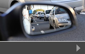


There has been a lot of comment during the past seven weeks of lockdown about how we should use this time to consider our road networks. Lockdown has meant a drastic reduction in the number of vehicles on the roads, leaving them open and safer for walking and cycling – activities that have been encouraged by government as part of the daily exercise routine.
And whilst it has been rewarding to see that noise levels have reduced, air pollution is lower than it’s been for some considerable time, and people feel safer to venture out and about on the roads, it’s not necessarily going to last.
Take the Government’s recent advice: go back to work if you can’t work from home, but avoid public transport.
Get back in the car
All our efforts in traffic surveys, traffic planning and road development in recent years have been around reducing the number of cars on the road. Schemes that favour bus, train and tram use – as well as cycling and walking – have been a significant part of the planning requirements for developments of all types across the UK. Some of these developments have been completed; some are under construction. But now, public transport use is being actively discouraged because it has the potential to put too many people together, risking increasing the R number as more people return to work.
So what does this mean? Roads will still be able to cope, of course. Not everyone is returning to work straight away, so roads remain quieter than usual; journey times are still quicker, and parking doesn’t present a problem. But as social distancing is likely to be one of the last barriers to be removed, it’s likely that we will be actively encouraged to use our cars more often, and avoid public transport rather than take it.
Car sharing won’t be an option, unless you’re driving with members of your household, so there will be a gradual increase in traffic on the roads and a gradual increase in the pressure on infrastructure – particularly parking.
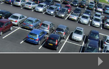
The battle for parking
This is certainly the case in cities, where parking is both limited and expensive. Those people who would normally commute by train, tube, bus or tram are likely to be looking for different ways to travel – and not everyone will be able to walk or cycle the distance between home and work. So perhaps it is time to take a fresh look at congestion points and at parking provision to ensure that we can help people return to work safely and easily over the coming months.
At RDS, we can support your plans with traffic surveys, parking surveys and a range of data collection options that help you to make informed decisions. To find out more, please contact us today.
At the end of the first week of March, the construction of a new bridge across the A45 was delayed because of technical difficulties with some of the equipment required to build it. This bridge, just north of Coventry Airport, was proposed as a way to tackle congestion by connecting busy areas and reducing the strain on existing roads. This bridge is part of the Coventry and Warwickshire Gateway strategy, a scheme to stimulate the region’s economic growth, which hopes to create thousands of new jobs, and this is unfortunately not the first time construction of the bridge has been delayed.
On the face of it, building new bridges and motorways in congested areas seems like a great idea. After all, every car that uses the new structure is a car not using the existing roads, reducing congestion and avoiding accidents. However, concerns have been raised that such structures may in fact worsen congestion because of a phenomenon called ‘induced demand’.
‘Induced demand’ is the idea that when a structure is built that makes using an area’s roads more convenient, more people begin using the roads. If places have better transport links, they become natural places for new building projects and so attract more people to live in the area – thereby increasing road usage. If an area becomes easier to commute in, it becomes more desirable as a place both to work and to live in. This may be why Los Angeles, a city with thousands of miles of road infrastructure, is incredibly congested in spite of this support.
Some argue that London benefited from the failure of the ringway scheme in the 1960s which hoped to build several more motorways around and through the city. The remnants of this scheme include the much-maligned M25. The reasoning is that more motorways would have pulled even more cars into the city and congestion could have ended up much worse: causing disastrous economic and environmental consequences.
Some experts question the relevance of induced demand, however, and argue that although more people will drive in an area if more highways are built, they only do so because of the reduced time and cost of doing so, and so congestion is still better for individuals overall. The validity of this is still unknown, and more work needs to be done to measure new traffic developments effects on congestion, as well as other consequences of increased road usage.
So, is a new bridge over the A45 the answer to congestion that the residents of Coventry want? Only time will tell.
If you need a Traffic Survey, Journey Time Survey, or similar data collection project to help investigate induced demand, or any issue effecting UK road users, contact Road Data Services today.
This month, Transport Secretary Grant Shapps announced that the government is considering updating the standard petrol blend in UK garages. Where the current standard is ‘E5’, a form of unleaded petrol with 5% Ethanol biofuel, the new ‘E10’ fuel would have double that amount. The reasoning for this is that increased ethanol content in fuel reduces the overall emissions of vehicles using it. Shapps estimated that this switch would be the equivalent to taking 350,000 cars off the road and, as such, would be a vital step towards the Government’s goal of net zero emissions by 2050.
However, the suggestion has attracted criticism from some motorist groups as they fear E10 will hurt everyday drivers. Studies show that E10 fuel may reduce fuel efficiency, increasing the cost of running a car. Some older cars are incompatible with E10 fuel, and while garages will still stock E5 for the cars that can’t run E10, it is unclear whether E5 will be sold at a premium if no longer the standard. Some also worry that, even for cars that can take E10, the fuel may cause more frequent corrosion damage due to Ethanol’s higher water content.
What has been less examined however, is the impact that a changing fuel landscape may have on traffic on UK roads. For starters, if the concerns of reduced fuel economy are valid, there may be more frequent refuelling stops. Other events that increase throughput at petrol stations, such as shortages or sudden drops in price, can often spill out and cause traffic issues on surrounding roads.
And if the decrease in fuel efficiency is significant and petrol stations aren’t prepared this could cause significant problems. Will an increased number of stops for fuel cause traffic jams as cars slow-down to make these stops? What we do know is that changes in anything traffic-related, from fuelling to new junctions; car-pooling to increased on-street parking can have a knock-on effect on congestion, journey times and quality if life.
At Road Data Services, we can provide detailed information to governments, local authorities, planners and developers through the use of precise traffic surveys, journey time surveys, and similar data accumulation methods. As the conditions for UK drivers change, we can provide you with strong data and analysis to drive evidence-based decision making. Contact RDS today to learn more.
The Prime Minister, Boris Johnson, released a statement this month announcing plans for transport infrastructure. The statement included references to reducing air pollution, although did not make clear exactly how the government would achieve this. Part of the government’s plans, however, focus on new investments in existing road infrastructure, including roundabouts.
What is interesting about this statement is that a connection seems to exist between a prevalence of roundabouts in urban spaces and a reduction in air pollution. A 2019 study, performed by scientists from Lancaster University in collaboration with the Birmingham Institute for Forest Research, found that cities such as Milton Keynes had significantly reduced air pollution compared to similarly-sized areas such as Luton. This could be the result of several factors: Milton Keynes has more frequent green spaces around its roads, and there may be a different ratio of private cars to public transport, but the study…suggests that roundabouts play a key role in reducing air pollution.
Why might this be? It could be because the central purpose of roundabouts, which is to ease traffic congestion at key junctions, results in smoother traffic flow, with fewer vehicles at a standstill with their engines running.
However, replacing dense intersections with roundabouts can be controversial. If not properly implemented a roundabout can do much more harm than good. For example, there are several roundabout systems in the UK that are reviled by the drivers who use them. Hemel Hempstead, also known as ‘the Magic Roundabout ’, usually tops the list, and the Haudagain roundabout in Aberdeen was recently named the worst in the UK.
Installing a new roundabout needs a detailed understanding of the behaviour of the region’s drivers and the amount of traffic expected to flow in and out in order to be effective at reducing pollution and controlling congestion. If the government is planning major changes to the nation’s infrastructure, those implementing the changes will need access to robust information about traffic and transport.
This sort of information is exactly what we offer at Road Data Services. Whether it’s a traffic survey, journey time survey, parking survey, or any other data collection, we can provide you with strong survey evidence to guide your decision making. To find out more, contact RDS today.
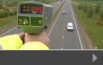
As the world moves into a new month, a new year, and a new decade, local councils and their citizens continue to tackle the challenges of making roads in their communities safer and less congested, using traffic surveys and local consultation to see how things could be improved.
Blanket speed limits
Kingston Council is currently taking feedback on a proposed blanket speed limit throughout the entire borough. This would mean that on all roads, with the exception of private roads and a few public ones controlled by Transport for London, the speed limit would be a flat 20mph.
On their website the council cites the greater majority of traffic accidents occurring on the roads with higher speed limits as evidence that it should bring them in line with its smaller roads in terms of speed. The council hopes that such a blanket speed limit will help with road safety.
Is faster safer
It is worth bearing in mind that lower speed limits don’t always translate to fewer accidents.
There are a several reasons for this, but an important one in this case is that the speed cars travel can matter less for overall safety than the difference in speed between different road users.
This is what has motivated some US states to actually raise overall speed limits on some of their highways, to bring them in line with the highways of neighbouring states, because people moving from one highway to another and being much slower or much faster than the cars around them causes more accidents than all speed limits being high but the same.
The UK Government has also acted on this reasoning, recently increasing the speed that lorries can travel on motorways to bring them in line with cars. Sometimes raising the speed limit can increase throughput, reduce congestion, and actually increase road safety. It may be that the roads with higher speed limits in Kingston have more accidents but that may be due to the difference in speed between roads rather than the speed itself.
The speed that fits the environment
On the other hand, smaller roads have different constraints to motorways; in particular the presence of road users who are limited to very low speeds: pedestrians. Pedestrians and cyclists are limited to much lower speeds and so increasing speed limits near to them could be dangerous.
Perhaps the best compromise is what Kingston council are doing: bringing all cars speeds down close to pedestrian speeds, but also keeping it consistent between roads.
Speed-related traffic surveys from Road Data Services
Are you contemplating a change in the speed limits on your roads? Do you need to know more about average speeds and journey times in order to plan for a less congested future? At RDS, we can design and undertake a wide range of traffic surveys to deliver the data you need to help you make informed decisions. To find out more, contact us today.
When imagining a road in Britain, most people will paint much the same picture: clearly marked lanes for cars at different speeds; additional lanes for bikes or buses; and a separate pavement for pedestrians. If roads meet, this is mediated by traffic lights and signs, and places for pedestrians to cross are likewise clearly marked. So-called ‘Shared Space Schemes’ are set to turn this assumption about the structure of roads on its head.
What is a Shared Space Scheme?
In shared space, there is no distinction between places where cyclists, pedestrians, public transport, and cars can go. All the road space is available for all road users. There are no traffic lights, no signs, no road markings, and no designated crossings. When travelling in a shared space, whether on a bike, in a car, or on foot, it is left up to the road users to navigate around each other safely and to decide who has right of way.
This may sound like it would cause chaos: without firm rules of the road, surely everything must be a roiling mess of traffic jams and accidents? However, when such schemes have been tried, both in Britain and elsewhere, they’ve consistently had much lower accident rates than standard road systems. One such scheme in Ashford, set up in 2008, found that accidents on its roads dropped from 17 in the three years before the scheme, to just four in the five years following. This may seem counterintuitive, but the reasons for it have deep implications for how British streets are designed.
First, drivers in shared space tend to drive more slowly and carefully for fear of hitting cyclists or pedestrians. They are also no longer distracted by traffic lights and excessive signage and so they can focus much more of their attention on the road, and spot things they may otherwise miss.
Secondly, pedestrians are much more alert to cars as they don’t have the perceived safety of crossings. They know that cars may be approaching them at any time from any direction and so permanently keep their attention on their surroundings.
Criticism for Lack of Accessibility
The surprising successes in Shared Space Schemes have come with problems, however. In particular, the idea has attracted criticism from Disability Advocacy groups such as the Royal National Institute for Blind People. The RNIB argue that such schemes make roads inaccessible to blind people, who can’t necessarily spot cars and steer clear of them in the same ways sighted people can. How to capture the benefits of Shared Space Schemes while keeping them accessible for all road users regardless of ability, is a challenge that is still in the process of being solved.
It’s perhaps a drastic change, and it would require a huge amount of investigation, including numerous traffic surveys, pedestrian surveys and a wide range of other data, to make the case. But as we look for new ways to manage travel and transport in the UK, shared space schemes are perhaps worth consideration at the very least.
There is an ongoing effort to manage congestion and traffic jams on the nation’s highways, by changing driver behaviour, making changes to new vehicles such as driver assist, or opening additional lanes and creating new roads to keep up with an ever-increasing road use. Most radical of all, however, is using technology to change the way that roads themselves work. This approach, creating what is called a ‘smart motorway’ has been being tested across the UK for several years now. However, this month, questions have been raised about the safety of these schemes, and many have come under review.
What makes a motorway ‘smart’?
Smart motorways or managed motorways work to actively manage a motorway from one or more control centres. These control centres then use up-to-date information about the state of traffic on the motorway and make changes to electronic road signs, altering the rules of the road in real time. Proponents of these schemes claim this can work to increase throughput, prevent dangerous collisions, and decrease congestion. Changes that may occur on the road include:
– Variable Speed Limits: Adjusting speed limits, increasing or decreasing them as road conditions require.
– Dynamic Hard Shoulder: When a speed limit is reduced, and there is a danger of the motorway becoming backed up, the hard shoulder can be used as an additional lane, increasing traffic flow significantly. When the hard shoulder is being used in this way, special emergency lay-bys become available.
– Dynamic Road Closure: Using electronic signs to warn drivers away from certain lanes where accidents or congestion have made them inaccessible, preventing last minute braking or sudden lane changes that can create traffic jams.
Not all smart motorways use all of these features. What defines a smart motorway is that a combination of electronic displays and a control centre allow changes to be made in real time.
Recent Safety Concerns
Concerns have been raised about whether smart motorways may be doing more harm than good. Last month the British Transport Secretary admitted that he was aware people were dying on these motorways and the system is in review. Critics fear that constantly changing speed limits and lane closures may confuse and distract drivers, taking their attention away from the road. Furthermore, inconsistent or entirely removed hard shoulders and small infrequent emergency lay-bys, may well put road users at unnecessary risk.
It is unclear whether these concerns can be ameliorated by changes such as increased driver familiarity or changes such as more frequent and larger emergency lay-bys. However, whether these changes will be enough to rectify growing safety concerns remains to be seen, meaning smart motorways may turn out not have been the magic bullet to reducing congestion that may once have been thought.
Managing traffic congestion
A way to help reduce traffic congestion is to conduct a thorough and precise traffic survey. At RDS, we specialise in traffic, pedestrian, parking and journey time surveys, helping to see where safely could be improved, congestion reduced and traffic managed more efficiently. To find out more, contact us today.
The issue of air pollution has been in the headlines recently, not least because of the Extinction Rebellion protests around the country during October. Many cities are looking for ways to improve air pollution, and the most obvious way to do that is to reduce traffic – surveys show that banning diesel vehicles in particular will have a positive impact and Bristol has already announced a plan to do that.
This follows the longer-term implementation of the Congestion Charge Zone in central London and the introduction of the Ultra-Low Emission Zone in the same city which, in a report on its early effect, found that the number of heavily-polluting vehicles driving into the zone had ‘fallen sharply’, with around 9,400 fewer vehicles on the road each day – a drop of around 26%.
Traffic surveys to measure reduction
Usually, traffic surveys are required in order to measure particularly congested areas, producing clear and accurate data for organisations who need to re-design existing roadways or build new ones. However, they can equally be used to measure a reduction in traffic where new schemes have been introduced either to reduce congestion or to improve air quality.
These surveys can distinguish between different types of vehicle, so that you can see what types of vehicle are using the roads less, and which types you are seeing more of. A comprehensive survey might include information on cyclists, pedestrians and public transport as well as the numbers of standard vehicles on the road. This then gives planners, developers and environmental service departments the information they need to see how innovative policies are working and what can be done to change or further improve things.
To compare data properly, a traffic survey should be completed before any measures are introduced. It might even be worthwhile conducting several over a period leading up to change, so that there is clear evidence of the volume of traffic in different areas or routes into the city. Once the new rules are in place and road users have got used to the new system, a further survey can be carried out to provide comparative data.
Traffic surveys from RDS
To find out more about benchmarking and comparative surveys, or to see how we can package our services to provide a comprehensive survey option, just contact us today.
Transport planners and traffic experts are in the middle of a revolution. Under pressure from government agencies, developers, pressure groups and more, they have to plan new routes, suggest highway improvements and balance the needs of business with the health and welfare of local communities.
Key transport planning considerations
- Congestion – the UK has a significant problem with congestion in its towns and cities. Increasing numbers of vehicles are using roads that do not have the capacity to cope, creating tailbacks and making journeys longer. Planners need to consider how to improve roads and junctions to reduce congestion, or whether to build new roads like relief routes to take traffic away from the busiest areas.
- New developments – the UK needs new housing and that housing needs to be supported by infrastructure. This creates additional traffic – most households run two cars – and so new developments need careful integration with existing road systems. In addition, planners have to consider the impact of new developments on existing infrastructure such as schools, shops and hospitals.
- Public transport – part of the solution to easing congestion is to invest in better, more reliable public transport and to make it safe for people to walk and cycle on busy routes – or provide safe alternatives. Local authorities may stipulate access to public transport or cycle routes for new developments, which may mean widening roads and pavements and designing new bus routes.
- Air pollution – the health and wellbeing of all road users and those living and working near roads has become a major issue. Whilst advances like electric vehicles help to improve air quality because they do not emit exhaust fumes, they still produce other pollutants from brake and tyre dust. So for many planners, the challenge is to reduce the number of vehicles rather than change the vehicle type.
For all these issues and more, transport planners rely on data to help them see how to reduce congestion, help businesses keep things moving, keep town centres alive and protect people’s health. That data includes targeted traffic surveys, parking surveys, journey time surveys and more – providing initial information that can be used as a benchmark as well as to guide decision making, and then re-surveying at a later date to check progress.
To find out more about tailored traffic surveys, contact RDS today.