
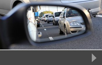
Is there an increase in car-free developments?
Whilst we often undertake parking surveys for new developments or changes in existing parking provision, there is an increasing number of developments where parking is heavily restricted or where planners have insisted on a car-free approach. What does this mean for parking in nearby areas?
What is a car-free development?
Most often found in areas that are already highly urban or where there are lots of new developments, a car-free development is one where parking is not provided on the development site, or there is no room for additional parking to be provided on the road where the development is situated.
As more planning departments insist on developments being able to access more sustainable transport options, such as buses, trains, cycling or walking, it’s likely that we will start to see more car-free developments, particularly in urban and suburban areas.
Car-free developments have to accept the non-provision of on-site parking or parking permits as a condition of planning permission. In most cases, residents may be able to apply for visitor parking permits, but these may be limited, and they won’t be able to apply for a parking permit for their own vehicle unless there are exceptional circumstances – and these vary from one local authority to another.
A knock-on effect
There may be people buying within a car-free development who have a car and need somewhere to park it. In most heavily-occupied urban areas, parking is controlled by resident permit, or by paid-for parking. Someone in a car-free development is unlikely to be able to get a resident permit, and so may have to park some distance away using paid-for parking. This adds to the expense of owning a car and is more inconvenient. It also puts extra pressure on the paid-for spaces which can in turn impact parking in the local area.
Pre- and post-development parking surveys
In order to assess the potential impact of car-free developments, developers and planning authorities may conduct a parking survey. This would look at the level of parking at different times of the day to see how demand changes and what impact there is on the local community – both residential and commercial. This includes delivery vehicles who have to park in order to make their deliveries, and trade vehicles who will be working on both domestic and business properties during the working day and will need permits or places to park. If car-free developments are likely to put a further strain on local parking, planning authorities need to look at how they might mitigate that potential risk.
To find out more about parking surveys, traffic surveys or other road data collection, contact us today.


Recent statistics from the Department for Transport shows that the number of miles travelled by cars on UK roads increased b 1% between April 2018 and March 2019.
Overall, all motor vehicle traffic miles increased by 0.8%, with a provisional estimate of 328.9 billion miles travelled during the period. Whilst traffic on motorways and A roads increased by 0.9% and 1.8% respectively, there was a decrease of 0.6% in traffic on minor roads. These figures are provisional at present, but show that there remains a trend for considerable road usage by motorists.
Traffic survey reveals long term trends
The Department for Transport statistics also include some long-term trends. Road use by cars has increased by 10.7% over the past 20 years. Vans have increased by more than 60% whilst lorry traffic has remained relatively stable. Overall, there has been a 15% growth in motor vehicle traffic on UK roads since 1999.
The Department for Transport has published several road traffic forecasts, based on a range of premises. What is certain is that the UK road network – from motorways to major A roads to our vat network of minor roads – will continue to see heavy traffic use for many years to come. That means we need to be constantly looking at how we can improve the network, reduce congestion, encourage people to share vehicles or switch to public transport and ensure that there is enough parking provision, particularly around new developments.
Prioritising traffic concerns
Traffic planning often dominates discussions about new development or regeneration projects. Issues of parking, access and increased numbers of vehicles on local roads are common points of contention. And this isn’t just about residents coming and going – it can be about construction traffic, delivery vans if developments are mixed use, and options for greener transport methods like bikes, public transport, electric charging points and pedestrian access.
Little surprise then that, given the impact of new traffic in areas right across the UK, developers and planning authorities want to be able to see exactly where congestion points might be and how they can alleviate them.
That’s why there’s a growing need for traffic surveys, parking surveys, journey time comparisons and more. At Road Data Services, we work with a wide range of clients across the UK to collect and report accurate traffic and road use data to help with informed decision making. To find out more about how we could help with your next project, contact us today.
One of the specialist services we offer at RDS is journey time surveys. These are dedicated surveys that test the average journey time from point A to point B. These journeys can be done at different times of day to see the difference in journey time between a rush-hour trip, for example, and a journey at a quieter time of day.
The data collected by a journey time survey helps planners and traffic managers to see exactly where the slow or congested parts of a route are, and how much impact they have on the time it takes to get from one point to another. Slower journeys have an economic and environmental impact, and collecting accurate data helps to assess this impact and see where improvements could be made.
How does a journey time survey work?
In order to collect accurate data, we take a vehicle on the journey between your two stated points. Using dashcam and manual evidence, we show every step of the journey, recording incidents or areas of concern.
At the start of the project, we’ll agree with you how many journeys to undertake and at which times of day. This will help to give you a spread of data, which is far more useful than the data collected from a single trip.
You may also want us to measure the journey time between the two points using a different route, so that you have one or more bases of comparison for the journey. This might help with diversions, or with signage that helps to reduce congestion.
Once we have completed all the agreed journeys, we can deliver the data we’ve collected, including video footage, so that you have a complete picture of the route and its issues. This gives you essential data to help you make informed decisions about any changes or re-routing to help the people using the roads in your area.
National travel time measures
The Department for Transport collects data on travel time for the strategic road network (SRN), and on local A roads. This data shows the average delay across the network, compared to a journey conducted at all the relevant speed limits. On the SRN 2018, for example, the average delay was 9.4 seconds per vehicle per mile. The average speed was 59mph. For A roads, the average delay was 47.3 seconds per vehicle per mile and the average speed 24.9mph. These statistics, both on a national level and when broken down to individual roads, give valuable information that allows planners to suggest areas for improvement to increase traffic flow and reduce congestion.
To find out more about how RDS can help you assess journey time, contact us today.
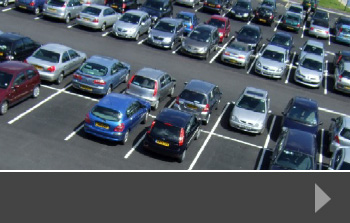
As we experience increased housing supply pressure, planners, developers and local authorities are looking for ways to redevelop existing urban sites into new housing rather than build on greenfield or even brownfield sites. Whilst this is a great way to provide new housing, it has a knock-on effect on the local area, and one area that can be particularly problematic is parking. Survey data collected before planning applications are made is one way to show the current impact of parking and project what impact new housing might have.
Understanding ‘parking stress’
Parking stress refers to the strain placed on both public car parks and residential streets by the demand for parking. This is something that is particularly problematic in urban areas, where street parking is most common, and where there are additional, non-residential stresses on parking, including people parking cars for local school runs, shopping and, particularly in cities like London, parking near railway stations in order to commute into the city centre.
Parking is often one of the biggest issues for existing residents and businesses when new urban developments are planned. So, from the point of view of both developers and planners, it makes sense to collect all the relevant data on current parking stresses as possible in order to have a clear basis on which to plan for the future and consult with the local community during the planning stages of the project.
Parking stress is usually expressed as a percentage – so 80% parking stress would mean that 80% of the available parking spaces are taken at the time of the survey. These percentages are likely to change depending on the time of day and the restrictions on the available parking. For example, if 50% of the available parking is resident permit only, there could be 100% stress on public parking spaces and less on the resident-only spaces.
A whole-development approach
Developers and planners also need to take into account the potential additional stress on local parking during the re-development stage. Often, parking is suspended in order to allow construction vehicles to park or other vehicles to deliver to the site. This reduces the number of available spaces during construction and places additional premiums on the parking that’s left.
Ideally, developers would be required to provide off-street, private parking for the homes they are creating. Although it’s likely that the new occupants will have visitors who will park locally, if the majority of day-to-day parking can be accommodated on a private site, this helps to relieve the stress of additional car users on the local area.
Detailed parking surveys from RDS
At Road Data Services, we supply tailored parking survey data to redevelopment parties, helping to influence good decision making and reduce as far as possible the issue of parking stress in urban areas. To find out more about how we can help, contact us today.
There’s no shortage of stories about the poor performance of public transport across the UK. In many instances, this is rail-related, with significant problems like the Northern timetable changes and running problems in the South East causing misery for commuters. But the alternative – travelling by car rather than by train – is causing increased traffic congestion.
Trying to beat congestion
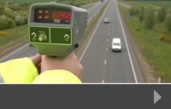
The government’s current road plans are all about reducing congestion, improving journey times and boosting the economy. A recent traffic survey from Highways England, which looked specifically at the current road improvement works in place, found that whilst rush hour journeys had improved, there was actually an increase in overall congestion in many areas. The exact causes are unclear, but they could include the signalling lights introduced as part of the works, and an increased number of vehicles on the road.
A good traffic survey measures volume of traffic and journey times at targeted points of the day. In many cases, this is the ‘rush hour’ which can vary from location to location and includes key congestion times like the school run as well as office hours when workers are travelling. Indeed, in some places, these two busy periods often run into one another, giving a good two-hour period in the morning and evening when the roads are particularly busy. Add in the inevitable road works – either for road improvement or for utility upgrades and repairs or other development work, and mix with unforeseen events like breakdowns or accidents, and it’s easy to see how congestion can quickly build.
The problem with that congestion is not just that it’s frustrating to be sitting in traffic; we are increasingly aware of the considerable damage to air quality that hundreds of idling engines create; and there is also a measurable economic impact for goods not being delivered on time and people being late to their workplace. It all adds up and, despite a significant road improvement programme across the UK, the issue still needs to be tackled.
The value of traffic surveys
Changes need to be made based on up-to-date, relevant data. Road usage changes as new housing or retail developments are built, schools are expanded or road systems change. In order to make the best planning and development decisions, people need the latest data, taken at the right times and at the right places. That’s where a sophisticated traffic survey from Road Data Services can help. To beat congestion, you need to start with the right information – to find out more, contact us today.
Urban planners and developers are continually looking for ways to regenerate or build new developments without quite so much focus on the car. Historically, developments have been largely planned around the car – roads in and out of developments; space for parking; calculations of journey times to the nearest business and commercial centres. Now that planners are looking at a different way of doing things, does the data generated by traffic surveys still matter?
Planning for better transport infrastructure
The answer to that question is ‘yes’. Whilst we may be trying to reduce car usage, lower pollution and alleviate congestion, the car is still the primary mode of transport for many. Reducing car use for new developments will mean being more careful about where the development is sited, and developers will need to ensure that buses or alternative forms of transport links are available so that residents and workers have a choice about how they get from A to B.
In the UK, space is finite, and nearly every new development will have to take into consideration the road network around it. This includes understanding the impact of adding, for example, an additional 2,000 cars to the road at peak times, or providing off-road parking so that roads are easier to drive on and less congested because of street parking. Developers also need to ensure that roads are safe for other users, such as cyclists of pedestrians – particularly as the levels of traffic increase.
Designing for life
The trend in urban planning and design is towards developments that are built as communities – people are much more likely to want to live somewhere that has green spaces, safe roads and community hubs. The more opportunity there is for people to cycle or walk to work – or at least to the nearest available public transport – the better it is for the environment, for our health and for general wellbeing. Developers are being encouraged to take a more people-centric approach, rather than vehicle- and access-oriented as they have in the past.
However, those assessing the success of these projects will still need to have the data to prove their effectiveness. Traffic surveys can provide data for benchmarking and comparison, as well as for essential decision-making information at the design and planning stage of a project.
To find out more about how our precision surveys can help you ahead of your next project, or to talk to us about working with you now, contact us today.
WhatCar Magazine’s Car of the Year 2019 is the all-electric Kia e-Niro. The magazine calls it: “… the first sensibly priced electric car that can fit into most people’s lives.”
This is the first time that an electric car has won Car of the Year, and it shows that car manufacturers are pouring money into developing cars that are more affordable, more practical and beat the barriers to entry for consumers – such as high prices, long charges and short distance-per-charge. But it also raises questions about how the road network can adapt to ensure that both electric and – eventually – driverless cars can use the network safely and smoothly.
What does this mean for our roads?
Traffic surveys across the UK show that our roads are becoming increasingly congested. Switching to electric vehicles won’t reduce congestion, but it will reduce pollution, helping to improve air quality and general health and wellbeing. It will also, in the long term, reduce the requirement for fuel from fossil-based sources, which again is positive for the environment.
But electric vehicles are still vehicles on the road, and our infrastructure needs to be able to cope with ever-increasing numbers of vehicles. Potential ways to manage congestion include:
Adaptive traffic management
We’re already seeing this at key junctions and on motorways. At junctions, smart traffic lights help to regulate the flow of traffic, based on the volume of traffic in the area. This helps to keep traffic running through the junction as smoothly as possible. On motorways, variable speed systems slow traffic down in advance of any potential problems, helping to avoid the stop-start nature of motorway delays wherever possible. Using the hard shoulder during congestion periods also helps to reduce traffic jams.
Toll roads
Whilst more popular elsewhere in the world than in the UK, there is a lot of work being done on dynamic toll lanes. Running alongside existing free lanes, these are charged for on a cash-less basis, with the toll price adjusted according to the volume of traffic in the lane. Drivers can plan their journey by seeing where it would be more efficient to pay for the toll, and where it’s fine to use the free lanes.
Autonomous vehicles
As technology advances and car manufacturers test and improve their autonomous functions, there’s a greater possibility of this technology coming to market. Sensors will automatically manage the car’s speed, handle merging from one road to another and drive at a more ‘average’ level, reducing the human driving patterns that contribute to congestion.
Road traffic surveys from RDS
At RDS, we welcome innovations that improve the condition of the UK road network and the ability of drivers to get where they want to go with the least possible disruption. Our work involves collecting valuable data on congestion, parking, journey times and more, to help planners and developers make informed decisions about the roads we use every day. Contact us to find out more.
In a development that’s likely to be replicated in other parts of the UK, Innovate UK and Oxfordshire County Council have made up to £250,000 available for organisations to develop a traffic management system that can accommodate both traditional road users and new transport technology such as self-driving cars and electric vehicles.
Traffic data to design the roads of the future
It’s likely that, within the next 5-10 years, our roads will look and feel very different. More people will choose to buy electric cars, and technology features will be introduced that take many of the driving decisions out of the control of the traditional driver. This in turn means that the road network will need to be able to manage these changes and, in highly developed and congested places like Oxford, this creates its own challenges.
The initiative, which is a Small Business Research Initiative, is competitive, with applicants being asked to design a traffic management system based on intelligent data gathering using infrastructure already in place in the county, such as CCTV, ANPR and traffic light control systems. According to a government press release, the system must:
- Use information from sources on the Internet of Things and share this data across a variety of teams and organisations.
- Allow Oxfordshire County Council to identify data gaps
- Produce data metrics that can adapt to council policies.
It must also be able to:
- Enable communication between traffic management and road users.
- Identify which modes of transport are being used.
- Explore integration with other council functions, such as emergency planning and social services.
- Integrate with artificial intelligence and machine learning.
Traffic data and road-use data is becoming increasingly valuable in a world where infrastructure planners cannot ignore the advances in technology, the pressures on the local, national and global environment and the desire of consumers to both move to more environmentally-friendly modes of transport, and still be able to make journeys quickly and easily. It’s thought that the biggest value in Uber, the taxi and ride-sharing business, is in the data it collects every day about the way people choose to travel.
Sophisticated traffic data from Road Data Services
With the latest in data-collecting technology, RDS can work with you on projects to survey existing road use, vehicle types, journey times, parking and more. We provide our data in whatever format is best for you, giving you a robust basis for planning and decision-making about the future of the road networks in your area. To find out more, contact us today.
Automatic Traffic Counts (ATCs) allow you to collect detailed data quickly and effectively, helping you to plan for the future. Here, we give you four good reasons why hiring someone to do this work for you is so valuable.
Regular traffic updates: For any road and traffic authority, having an up-to-date overview of what’s happening on the roads is crucial achat viagra en ligne canada. The right information can give you a head start when it comes to planning short-term developments like road improvements, or long-term projects such as new road building.
Minimise disruption: There are many ways to collect this information; from a standard vehicle counting system to air-pulse recording devices. All of these can be installed and activated without disrupting traffic flow, allowing traffic surveyors to collect accurate data over a defined period of time.
Improve forecasting: New developments have a wide range of interested parties, including the road development authority, local developers and planners and of course the community. When large developments are being planned and tested, the ability to forecast the potential strain on the road system is vital. Undertaking an automatic traffic count gives you the information you need, in the format that suits you best.
Not just traffic: Planners who combine people and vehicle counting alongside other road users such as cyclists, get a more complete picture of what is happening in their local area, and can plan to ensure that all road and pavement users are properly catered for. Using a range of survey services, including parking and pedestrian surveys can save time and money during the costly planning process.
Automatic Traffic Count services from RDS
At Road Data Services, we offer a range of methods for collecting automatic traffic count data, supplying information across 13 classes for transport. These include tube-based Metrocount systems and volumetric devices and we supply data in whichever format is best for you. To find out more about our services or to talk about a particular ATC project, please just contact us today.